Digital soil maps for all of Europe
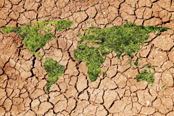
Soil degradation is a growing environmental threat that affects water and air quality, biodiversity and climate change. To manage this problem, we must first understand its extent. This can only be accomplished by soil mapping, an often imprecise and costly undertaking. Scientists are taking a fresh approach to this subject in the context of the 'Interactions between soil related sciences – linking geophysics, soil science and digital soil mapping' (Isoil) project. Financial support from the EU is being used to evaluate a number of new soil sampling techniques. The Isoil team narrowed its focus to mobile, non-destructive methods in order to reduce time requirements while expanding geographical coverage. Emphasis was placed on reproducibility of results. Soil samples have been collected to help derive the relationship between sensor feedback and actual data, which is expressed as a geophysical transfer function. Finally, models are proving extremely useful for examining the connection between soil features and geophysical parameters. Other important work being performed by the Isoil scientists includes development of guidance to harmonise efforts by soil researchers spread across the globe. Standards for specific methods are also in progress. Dissemination of this information, which is accomplished through dedicated workshops, is therefore an integral component of the project.