Reaching new heights in geomonitoring
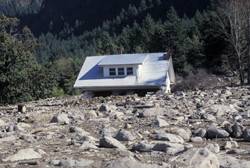
Rockfalls, landslides and avalanches cause tremendous damage and pose a real threat to inhabitants, buildings and infrastructure in mountainous areas. The need to monitor areas highly prone to geohazards is also a result of the increasing probability that such events occur due to climate changes. However, current sensor concepts usually cover a short range — that is, up to just a few kilometres. The 'Deformation monitoring by high resolution terrestrial long range sensing' (DE-MONTES) project aimed to overcome this limitation. Researchers joined their efforts to implement an innovative geomonitoring concept based on modern measurement technologies. The new fully automated sensing system was designed to detect deformations early enough for protective measures to be taken. Taking a step beyond existing measuring systems, the participating small and medium-sized enterprises (SMEs) introduced a modular suite of visual sensors. Image-assisted total stations (IATSs) provide extremely high accuracy and the ability for long-range measurements. In complement with laser scanners for terrain surveying, IATSs offer a powerful tool for monitoring isolated mountainous areas with limited access. The combination of high-precision visual data with lower-resolution laser scans and digital photogramme try promise 3D deformation measurements with accuracy down to millimetres. The DE-MONTES system is also able to select suitable algorithms based on the target area characteristics to support data analysis and interpretation with the use of mathematical models. By the time the DE-MONTES project was completed, a prototype was available to demonstrate the main features of the modular geomonitoring system. The partner SMEs are also able to acquire new business by exploiting the system and its components in related application areas, such as tunnelling and construction, documentation of cultural heritage and industrial inspection. Watch the project’s video here.
Keywords
Geomonitoring, image-assisted surveying, geohazards, deformation monitoring, long range sensing