3D cityscapes
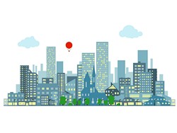
As sensors and imaging systems become commonplace, linking various kinds of sensor data becomes increasingly easy. Such linkage permits integrated digital 3D representation of the urban world, which can be used to solve problems. The EU-funded AR3WS (Acquiring and responding to the 3D world, smartly) project extended the acquisition and use of such data. The team devised algorithms for combining photographs and 3D lidar scans of cityscapes, plus a method for analysing acquired data for degradation. Researchers also refined interactive navigation of scenes, which enables the detection of damage, planning building modifications or predicting possible uses of parts. Project investigators developed algorithms supporting acquisition and exploitation of various forms of data. Such data included time-of-flight scans, photographs, GPS readings and keywords. The team was able to determine the relationships among the various kinds of data, and to represent the relationships for indoor and outdoor scenes. Results showed that increasing amounts of data stabilised the system. Incoming data was validated and adapted to the current model, allowing large-scale reconstructions of building interiors at unprecedented scales. The team developed an optimal global registration algorithm that permits scans in arbitrary initial poses and allows global point cloud registration. The algorithm also solves problems related to the unknown overlap between pairs of scans. The tool is simple and efficient, resulting in significant acceleration compared to alternative approaches. Finally, researchers developed an interactive system that streamlines the process of preserving model relations among various parts of an object. The process allows designers to virtually move parts around to determine fit. The project’s achievement enables intuitive manipulations, whereby designers may rapidly explore various 3D architectural design possibilities. The AR3WS system optimises the model geometry for production of working designs. Prototype software was tested and demonstrated on various works-like prototypes. The AR3WS software tools enable efficient combination of various kinds of geographic and spatial data representing cities and buildings. Doing so means a more rapid design process, enabling exploration of options that would otherwise be difficult.