GEO-CRADLE – Earth Observation activities in North Africa, the Middle East and the Balkans benefit citizens and business
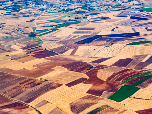
Earth Observation (EO) is a valuable tool for monitoring different facets of sustainable development, such as agriculture and food productivity, water resources, air quality, clean energy and climate change. The EU-supported GEO-CRADLE project, hosted by the National Observatory of Athens(opens in new window) (NOA), was set up to maximise the use of EO resources across North Africa, the Middle East and the Balkans (NAMEBA), to bring about progress towards sustainable development.
Prioritising end users
GEO-CRADLE began by conducting an inventory of available EO capacity in the NAMEBA region for a better understanding of monitoring as well as modelling and computing capacity. A Networking Platform(opens in new window) was then created to present the status of regional capacity and to organise and sustain a community of stakeholders tasked with improving it. GEO-CRADLE organised 17 Regional Workshops(opens in new window) to showcase EO’s potential to new end users, particularly for areas with recognised knowledge gaps. These events also afforded opportunities for participants to establish new collaborations such as partnerships covering issues of common interest, both regionally and nationally. Regional Coordinators (one covering the Middle East and North Africa region, the other the Balkans, plus Cyprus and Israel) were appointed to co-organise the workshops. This approach also helped address any challenges emerging from the project’s wide geographical scope with its diversity of cultures, languages and politics. “The involvement of end-users from the very beginning to co-create products and services was crucial to ensure their successful usage,” says Haris Kontoes from NOA, and GEO-CRADLE project coordinator.
Pilot light
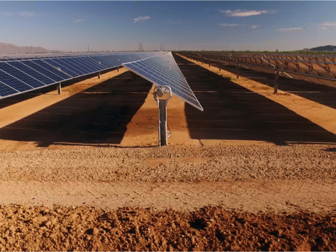
GEO-CRADLE conducted four thematic pilots(opens in new window) in areas identified as regional priorities: Adaptation to Climate Change; Improved Food Security – Water Extremes Management; Access to Raw Materials; and Access to Energy. Taking one example of a successful pilot initiative, in Egypt a Solar Atlas(opens in new window) was created to help identify the best locations for photovoltaic parks and solar plants. As a result, new solar farms were constructed in 29 locations, such as at Benban in the Aswan Governorate, where a 1.8 GW solar farm will provide green energy to more than 80 000 houses, while also contributing to the wider energy mix in Egypt. Indeed, the impact of the Solar Atlas has been referenced at Egyptian Ministerial level a few times, including by the Minister of Electricity and Renewable Energy who highlighted its potential to: “Meet the mandate of the investors and fund providers, resulting in better schemes of energy production and hence in customer satisfaction.” Artificial intelligence and machine learning techniques were indispensable for GEO-CRADLE to accommodate the complexity and volume of real-time EO data, useful for its products and services. “GEO-CRADLE’s state-of-the-art EO activities and tools helped our user community better understand changing climate impact and design ways to better respond,” explains Hesham El-Askary, the Regional Coordinator for the Middle East and North Africa and contributing author to the Desertification Chapter of the Intergovernmental Panel on Climate Change’s August 2019 report(opens in new window).
Setting the standard
"GEO-CRADLE solutions are guiding the decisions of several NAMEBA authorities about large-scale climate, food and raw materials mapping; as well as for the detection of any changes and anomalies,” notes Kontoes. Building on GEO-CRADLE’s success, some activities will continue and even promise to trickle down into areas and regions outside the project’s scope. Indeed, GEO-CRADLE is now officially a Group on Earth Observations Initiative(opens in new window) and will extend its services both geographically, to the Black Sea, and thematically in support of three priorities areas: Climate Change; Disaster Management; and the Sustainable Development Goals(opens in new window).