

Arctic sea ice thickness 'nose-dived' last winter
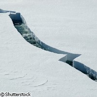
Last winter, the Arctic sea ice was half a metre (approximately 20%) thinner than in the previous five winters over parts of the Arctic, according to new EU-funded research published in the journal Geophysical Research Letters. Over the Arctic as a whole, ice thickness declined by some 26cm (10%). The scientists used the European Space Agency's Envisat satellite to measure ice thickness over the Arctic winter, which runs from October to March, from 2002 to 2008. Previous research highlighted the thinning of the ice in a small region around the North Pole last winter but this is the first study to show that the ice thinning was widespread and occurred in areas of both young and old ice. The average winter thickness of the Arctic sea is approximately 2.5m and during the first five years of the study the ice thickness remained relatively stable, showing only a slight decline. However, in the winter of 2007-08 it declined by 26cm in comparison with the average thickness for the previous winters of the study. The area that was most affected was the Western Arctic, where the ice was 49cm thinner than usual; in the North Chuckchi Plateau the ice was 89cm thinner than usual. This raises the question of why the ice thinned so dramatically last winter. In the summer of 2007, the Arctic ice shrank to its lowest extent since records began. 'Firstly, a reduction in the quantity of first-year ice left at the end of the melt season reduces the amount of second-year ice,' the scientists write. 'Secondly, a greater exposure of the ocean during the summer, leading to increased solar heat input, would inhibit ice growth during the following winter.' The low ice extent of 2007 is widely attributed to the unusually warm weather in the Arctic that year. However, in 2008 the ice shrank to within a whisker of the 2007 levels, even though the temperatures were much lower over the Arctic this summer. 'The extent of sea ice in the Arctic is down to a number of factors, including warm-weather melting as well as currents and the wind blowing it around, so it's important to know how ice thickness is changing as well as the extent of the ice,' explained Dr Katharine Giles of the Centre for Polar Observation and Modelling at University College London (UCL) in the UK. 'This summer's low ice extent doesn't seem to have been driven by warm weather, so the question is, was last winter's thinning behind it?' In other words, the ice may have been 'preconditioned' to melt during the summer of 2008 by the thinner ice cover during the preceding winter. Further studies are needed to confirm this idea. 'We'll be keeping our eyes on the ice thickness this winter as it'll be interesting to see what happens after a second summer of low ice extent,' added Dr Seymour Laxon, also of UCL. The Envisat satellite used by the researchers does not cover the Arctic above 81.5° North, which is about 965km from the North Pole. The European Space Agency plans to launch a new satellite, called CryoSat-2, at the end of 2009. CryoSat-2 is specially designed to measure ice thickness in high resolution over the entire Arctic.
Countries
United Kingdom