

New world map highlights urbanisation trends
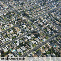
Over half of the world's population now lives within an hour of a major city, but just 10% of the world's land area is more than 48 hours away from an urban centre. These are just two of the findings from a new global map of urbanisation produced by the European Commission's Joint Research Centre (JRC) for the World Bank's World Development Report 2009. The JRC and World bank developed a new measure called the 'agglomeration index' to study urbanisation trends. Previous studies have used national definitions of urban areas, but these often vary from country to country. As well as using population density to identify urban areas, the agglomeration index looked at the travel time to urban centres in the 8,500 major cities worldwide with populations over 50,000. Travel time was calculated on the basis of terrain and the existing local transport infrastructure. The scientists' analyses revealed that some 95% of the world's population lives on just 10% of the land, and that over half of the world's population lives within one hour of a large city. However, there are stark differences between developed and developing countries. In the developed world, 85% of the population lives within an hour of a city; in developing countries, where there are fewer large cities, the figure is just 35%. Some of this difference can be also accounted for by the fact that commuters in developed nations have access to speedier transport options in the form of better roads and faster public transport systems. In the developing world, their counterparts often rely on slower forms of transport such as walking, cycling or inefficient buses running on poorly maintained roads. Access to urban areas brings with it access to some of the best cultural, educational and health facilities. Urban areas also provide jobs and act as hubs for communication and transport. There is a flip side to this increased connectivity: the map also highlights the fact that the world's wild areas are now less remote than they used to be. Only 10% of the world's land area is more than 48 hours' travel time away from a large city. Europe is particularly densely populated. 'There is almost no wilderness left,' Alan Belward of the JRC told CORDIS News. 'We have risen to the challenge of combining various information sources with the latest mapping technologies to produce a unique and timely product for the World Bank,' commented Leen Hordijk, Director of the Institute for Environment and Sustainability at the JRC. 'Our map raises the question: for how much longer will remote ecosystems remain remote? Many are crucial to the healthy functioning of our planet.' 'The latest computer-aided mapping and modelling technologies, such as those developed by the Joint Research Centre, paint a unique picture of our planet - a picture that shows how increasingly connected we all are, especially within Europe,' added EU Science and Research Commissioner Janez Potocnik. 'This brings home just how important it is to manage our resources, lifestyles and economies in a sustainable manner.' Meanwhile, the scientists hope that the newly-created 'agglomeration index' will prove to be a useful tool for those studying the impacts of urbanisation.