Sensor innovations deliver accurate water quality monitoring
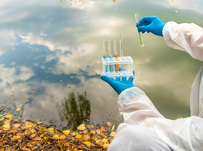
Aquatic ecosystems are threatened by human development, pollution and various industrial uses. Monitoring water quality is therefore critical to protecting aquatic life, by helping to identify issues early and enabling effective action to be taken. “Satellites provide unparalleled observation coverage of oceans, coastal zones and inland waters,” says MONOCLE(opens in new window) project coordinator Stefan Simis from the Plymouth Marine Laboratory(opens in new window) in the United Kingdom. “However, atmospheric interference can make for less reliable results. These are difficult to predict without reference observations taken on the ground.” A key challenge in providing reliable satellite products, for example to show algal blooms or pollution associated with land run-off, is the scarcity of suitable in situ observations to compare them to. This lack of data is global, but particularly evident in developing regions.
Accurately measuring water colour
The goal of the EU-funded MONOCLE project was therefore to improve water monitoring by lowering the cost of optical sensors, to help calibrate satellite data. The project team also wanted to ensure that all sensor-based solutions were affordable and available to as many people as possible. To achieve this, they developed highly autonomous systems to lower the cost of maintenance and data processing, as well as low-cost devices which could be used by non-experts. They used open-source licencing and developed training materials for independent users. In total, eight low-cost sensor systems and associated data services were developed. These include three reference radiometry(opens in new window) systems, imaging cameras installed on consumer-grade drones, and colour and transparency observations. These innovations were then tested within existing citizen science groups to ensure usability and assessed against technical and cost specifications. “Of the demonstration products we made, some are now available for purchase,” notes Simis, “Supplier contact information is available through the project website, along with an overview of ways to interact with, and contribute to, the growing collection of data generated by MONOCLE devices.”
Methods to integrate data
The future involvement of citizen scientists to help in the collection and interpretation of data received special attention in the MONOCLE project. A key step is to ensure that these data can be integrated with satellite observation and high-end reference stations, enabling scientists to rely on quality-assured data from multiple sources. “These methodologies – along with the demonstration cases – have highlighted the importance of non-expert observations in data-poor areas,” adds Simis. “While the technology is ready, engagement of communities to tackle local issues will now be the key.”
Range of data services
MONOCLE project participants are confident that in situ observation networks such as those demonstrated – which harness both autonomous and participatory observation strategies – will dramatically improve water observation coverage and deliver more accurate measurements. The team will continue to support the innovation potential of app developers, environmental consultants and data analysts, well beyond the duration of the project. This is because all data services are designed to be non-exclusive, operating using interoperable data standards of the Open Geospatial Consortium(opens in new window) (OGC) and allowing most reuse. This system allows developers to connect to data services with data visualisation and analysis tools providing user interfaces which can be readily extended. “Expanding our sensory network will help global space agencies and services to calibrate their satellite-based data and validate information concerning optically complex waters,” says Simis. “Citizen science can also help support environment agencies by complementing or redirecting efforts from routine monitoring, particularly at locations that are currently under-sampled.”