Fire-spotting from satellites
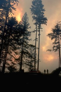
A wide range of sensing techniques are combined with aerial photography in order to analyse the likelihood of fire starting in any particular area, as well as to monitor the progress and effects of fires. The predictive possibilities of the system are the most innovative aspect and those that offer both economic and environmental benefits. Promising results have so far been obtained from the conjunction of low and high-resolution satellite sensors, though further research is required on some aspects of the remote sensing methodology. Not only the rapid response to forest fires, but also their anticipation and prevention, might be facilitated by remote sensing equipment being tested by the MEGAFiReS project. The monitoring of large and inaccessible forested areas can be made much easier by use of satellite technology.