Collecting oil spill data
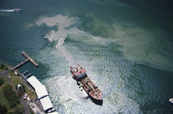
Collecting the necessary knowledge for the establishment of a more efficient means to monitor oil discharges in European waters is a challenge that has been met. This ability is the result of a novel tool which has accumulated vast amounts of data obtained and classified by various standards. The data are a product of observations via aircraft as well as from satellite radar images. The data can be used as a genuine, unbiased means in a wide array of applications. Fundamental in this ability is the fact that the results enable the access of all data from a single source. They have also formed a mutual set of standards for the basis of inclusion in the database. Furthermore added value to products is possible because of the implementation of a specific statistical methodology. The tool is capable of performing multiple tasks. These include long-term monitoring of marine oil pollution evolution at European scale, pinpointing hot-spots related to the problem and assessing the effectiveness of measures taken in specific areas. The database is currently in use as a starting point for local/regional studies on the evolution of marine oil pollution as requested by National Authorities and European Union Services. It is publicly accessible through a viewer on a dedicated website and additional information may be requested in GIS compatible format.