Watching the seas
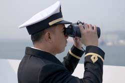
Europe needs the capacity for continual satellite monitoring of its coasts and seas, yet current options are unintegrated and inadequate. The numerous applications of potential new surveillance technologies include border control and fisheries. The EU-funded NEREIDS (New service capabilities for integrated and advanced maritime surveillance) project aimed to provide an integrated vision of European maritime policy and surveillance. Specifically, the goal was to enhance European capabilities for automatic ship monitoring in addition to providing advanced decision-making tools. Technical targets included developing a test benchmark for assessment of new algorithms. The algorithms, based on a distributed processing architecture (service-oriented architecture), were intended to overcome conventional system drawbacks and deliver new features. The proposal was unusual in being interoperable with other operational systems. The 18-member consortium ran for 3 years to mid-2014. Work resulted in several remote-sensing candidate technologies. The list was suitable for law enforcement and related applications, plus environmental monitoring. Highlights include a detection system using Synthetic Aperture Radar (SAR), able to locate and track small targets, and automatic target categorisation using the SAR data. Project results also made both outcomes possible for the first time using optical data and fully automatic algorithms. The consortium achieved advanced fusion approaches able to cope with multi-sensor data and other complexities. Other new capabilities included constraint-based track reconstruction, complex anomaly detection, and propagation of vessel routes for compilation and analysis. The system architecture was compliant with current standards, and able to incorporate any sensor. The project's advanced database structure permitted multi-user and multi-purpose approaches. A real-time graphical user interface yielded views of processed scenes comparable to real life. Team members developed and tested the system over nine campaigns at a variety of locations, and using realistic detection scenarios. Results for the expandable system proved satisfactory. Furthermore, project researchers made several technical recommendations concerning future development work. NEREIDS developed numerous remote-sensing processing technologies to be used for marine surveillance and law enforcement. The system of systems concept performed well; also, the final product interface was familiar to users, lessening the need for training.