High-precision snow cover and glacier mapping
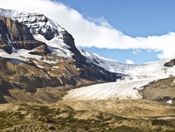
Seasonal snow and land ice are important resources supplying major parts of Europe with water for agriculture, hydropower generation and human consumption. Not surprisingly, data are needed on a daily basis by stakeholders as diverse as climate monitoring bodies, hydropower companies and avalanche warning centres. To provide all these potential users with the information they need, the CRYOLAND(opens in new window) (GMES service snow and land ice) project relied on the EU's Copernicus programme. This fleet of satellites and ground stations is currently being developed to monitor the Earth's atmosphere, ice caps, land and oceans. The satellite data are processed using algorithms and automated techniques developed to calculate the extent of snow coverage and the snow melt area. Satellite observations deliver precise and up-to-date information on snow, glaciers, lake ice and river ice with appropriate spatial coverage. CRYOLAND was geared towards developing a self-sustainable service to support snow and land ice monitoring as a downstream service within Copernicus – in a value added chain with the land monitoring services. The portfolio of snow and ice products was designed to match user requirements. For this purpose, a thorough user requirement survey was conducted to derive targeted requirements as well as recommendations for the priorities of the new service. The majority of the users were mainly interested in the snow services, but lake and river ice products were also desired. The user requirement survey also highlighted the need for a pan-European service for snow water equivalent. Copernicus satellites Sentinel-1, -2 and -3 were well suited for addressing most of the product requirements when they become operational from 2015. The CRYOLAND Geoportal(opens in new window) offers interactive maps through web browsers as well as search and download functions. The near-real-time services of products highly relevant in water resource management and a field of other applications have been extended beyond the lifetime of the project.