

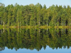
Forest carbon and water balance modelled with satellite data
The EU-funded NORTH STATE(opens in new window) project used satellite imagery data to predict forest variables such as land cover and wood biomass. These estimates were then placed into carbon balance models together with climate data to create the basis for operational carbon balance prediction systems. Researchers combined Sentinel satellite data from the Copernicus programme with models to monitor carbon and water fluxes across Europe’s boreal forest and subarctic region. The parameters used included forest characteristics such as area and species, tree height, biomass and model drivers such as incoming radiation, and indicators of the dynamic state of the forest, such as leaf area index. Algorithms developed for predicting the input variables of the carbon and water balance models were applied to forest biomass estimation and other operational uses. They also helped to streamline the image interpretation process and the use of carbon flux models based on large amounts of Earth observation-based data. Such a range of variables on forest structure (height, basal area, volume) at a high spatial resolution was previously not available to forest models. Although this data can be used for forest mensuration purposes, it was also used as input for forest models and in validation of dynamic vegetation models. This allowed scientists to estimate carbon and water fluxes and stemwood growth as a measure of the current state of the forest. If the data are available on a long-term basis they may be used for monitoring clear-cutting or large-scale damages from storms and fires. NORTH STATE outcomes will help to improve forest management, forest primary productivity, and carbon cycle estimation and reporting. This will result in better decisions in forest management and benefits in carbon reporting, leading to economic gains and strengthened European leadership in the provision of Earth observation-based services for the analysis of northern forest-dominated ecosystems.


