


ESA teams up with Air France to show earthly images
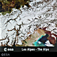
Air travel could soon become more interesting thanks to an onboard picture show. The European Space Agency (ESA) has announced that passengers aboard select Air France flights will soon be able to see satellite images of the land over which they are flying. The images integrated into the in-flight Geovision programme will begin with captivating images appropriate to the routes of Air France flights operating between Paris and Singapore, Delhi, Mumbai and Bangalore. ESA has selected 250 images acquired by various satellites, including ESA's Envisat and Proba, Korea's Kompsat and France's Spot satellites. 'Integrating satellite images into Air France's in-flight service provides an excellent opportunity to create public awareness and interest for space technologies, and in particular for those related to Earth observation,' says ESA Head of Communication Fernando Doblas. 'The imagery has been specifically chosen to afford passengers the possibility to tour the planet from a bird's-eye view and to gain a different perspective and appreciation of Earth by witnessing its splendour as well as its vulnerable spots,' he added. Since their advent, Earth-observing satellites have become powerful scientific tools for enabling a better understanding of the various components that make up the Earth system - land, ice, atmosphere, biosphere and oceans - and how these processes interact and influence one another. Acquired continuously, satellites provide reliable and timely information about the state of our world, allowing us to improve our management of the Earth and, thus, our quality of life.