

Permafrost thawing fast, alert scientists
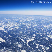
When permafrost thaws, it releases greenhouse gases into parts of the Arctic, exacerbating the effects of climate change. And now, detailed satellite images have picked up on changes in land surfaces at northern latitudes, indicating that there are worrying levels of thawing permafrost. The findings were made by European Space Agency (ESA) scientists using several different satellites including the Environmental Satellite (Envisat). The researchers were able to get a panoptic view of permafrost phenomena from a local to a circum-Arctic dimension. Although permafrost cannot be measured directly from space, satellites can capture indicating factors such as surface temperature, land cover and snow parameters, soil moisture and terrain changes. Permafrost is ground that remains at or below 0°C for at least two consecutive years; it usually appears in areas at high latitudes such as Alaska, Siberia and northern Scandinavia, or at high altitudes like the Andes, the Himalayas and the Alps. About half of the world's underground organic carbon is found in northern permafrost regions, this amount is more than double the amount of carbon in the atmosphere in the form of the greenhouse gases carbon dioxide and methane. While in many of the world's urban areas, the effects of climate change can, for now, be brushed under the carpet by sceptics, in the Arctic, the region hit hardest by climate change, its effects are severe and undeniable: it is causing permafrost to thaw fast. This thawing triggers the release of greenhouse gases into the atmosphere and in turn heightens the global effects of climate change. Dr Hans-Wolfgang Hubberten, head of the Alfred Wegner Institute for Polar and Marine Research in Germany and President of the International Permafrost Association, comments: 'Combining field measurements with remote sensing and climate models can advance our understanding of the complex processes in the permafrost region and improve projections of the future climate.' The ESA will continue to monitor the permafrost region with its Envisat satellite and the upcoming Sentinel satellite series under the EU-led Global Monitoring for Environment and Security (GMES) programme. ESA is developing five families of Sentinel missions specifically for GMES, the first of which is scheduled to launch in 2013. The Sentinels will provide a unique set of observations for GMES, starting with the all-weather, day and night radar images from Sentinel-1 to be used for land and ocean services. Sentinel-2 will deliver high-resolution optical images for land services and Sentinel-3 will provide data for services relevant to the ocean and land. Sentinel-4 and Sentinel-5 will provide data for atmospheric composition monitoring from geostationary and polar orbits, respectively. GMES is made up of several projects partly financed through the EU's Seventh Framework Programme (FP7), and is organised in partnership with the ESA, in charge of the Space Component, and the European Environment Agency (EEA), in charge of collecting data from airborne and ground sensors. The most ambitious Earth observation programme to date, the global aim of GMES is to provide, accurate, timely and easily accessible information to improve the management of the environment, understand and mitigate the effects of climate change and ensure civil security. Accurate information delivered in time can help us manage natural resources and biodiversity, observe the state of the oceans, and monitor the chemical composition of our atmosphere.For more information, please visit: European Space Agency: http://www.esa.int/esaCP/index.html(opens in new window)