Using remote sensors for better drought monitoring
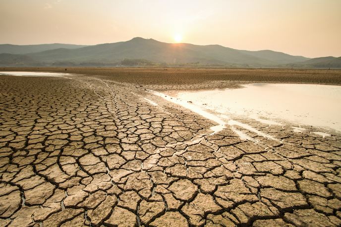
Climate change is having a profound impact on global precipitation. With the Earth’s mean temperature continuing to increase, many regions are starting to see total annual precipitation rates decrease. As they do, these regions will likely experience significant drying, extreme droughts and unprecedented heat waves. Already, large-scale droughts have resulted in high economic and social costs across the world. In 2003, Europe witnessed one of its hottest and driest summers ever. This heat wave not only had a significant impact on Europe’s economy and natural environment, it was also responsible for numerous deaths. To help mitigate and adapt to such extreme droughts, the European Commission established a European Drought Policy(opens in new window). The policy supports initiatives aimed at understanding the temporal variability of drought patterns and its impact on ecosystem dynamics. One such initiative is the Marie Skłodowska-Curie programme(opens in new window) supported INDRO project. “The remote sensing (RS) indicators currently being used by the European Drought Observatory’s(opens in new window) early monitoring system are not perfectly suited to capturing the rapid changes in plant photosynthesis,” says Manuela Balzarolo, a fellow at the Centre for Research on Ecology and Forestry Applications(opens in new window) (CREAF) and the project’s lead researcher. To improve this, the INDRO project focused on defining new RS indicators capable of monitoring vegetation status and how it responds to drought.
Using remote sensing indicators
It is widely understood that intermittent droughts lead to abnormally high atmospheric carbon dioxide growth rates, and that this impact will only become more profound in the future. One way to analyse the effect this has on terrestrial ecosystems is through RS techniques. “Remotely sensed indicators of plant photosynthesis are an effective way of obtaining real-time conditions of ecosystems,” explains Balzarolo. “RS also offers a range of spatial and temporal observations on changes in an ecosystem’s structure, function and services.” By investigating this relationship between remotely based indicators and plant physiological status at the global scale, Balzarolo gained a better understanding of the spatial and temporal variability of an ecosystem’s gross primary productivity (GPP) under several environmental conditions. She was also able to verify which vegetation and environmental factors are the most important for determining GPP and light use efficiency variability. “From this research, it was discovered that drought-related variables have an impact on annual light use efficiency in temperate forests, while temperature-related variables affect the annual light use efficiency of cold forests,” says Balzarolo. “Furthermore, we found that the seasonal variability of light use efficiency is strongly related to meteorological variables and is the strongest in the summer.”
Building early-monitoring systems
The project is an essential step towards building the early-monitoring systems needed to better mitigate the environmental and economic impact of droughts. “Balzarolo’s work provides a comprehensive, up-to-date picture of the use of RS techniques for monitoring the effect droughts have on ecosystems,” says Josep Penuelas, Balzarolo’s mentor at CREAF. “In doing so, she has advanced our understanding of the impact that climate change-induced droughts will have on our global society.”