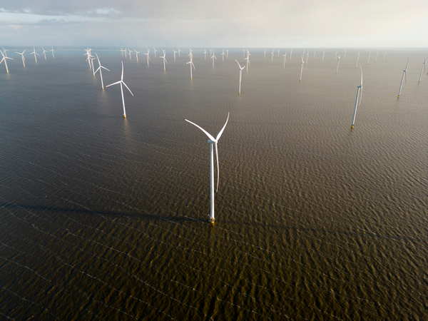
Satellite data improves European coastal management

The Copernicus Marine Environment Monitoring Service (CMEMS)(opens in new window) has the potential to help stakeholders in coastal zones to make informed decisions on erosion and flooding mitigation, renewable marine energy extraction, port exploitation and environmental management. The EU-funded CEASELESS(opens in new window) project set out to improve coastal sea predictions using in situ and Sentinel(opens in new window) satellite data. The project combined high-resolution models with observations from different sources to advance coastal sea predictions for regions in the Mediterranean Sea and the North Sea. “This advance is an important element for safer and more sustainable coastal zone management,” says project coordinator Agustin Sanchez-Arcilla. Sustainable coastal management is set to benefit coastal stakeholders such as port and coastal authorities or marine windmill farms.
Combining different data sources
The CEASELESS team used high-resolution numerical models that resolved numerical grid sizes in the order of 50 m or even smaller, in combination with Sentinel satellite data, to distinguish the more exposed areas for marine wind energy. The team used in situ data to analyse how individual storms grow and decay, in support of risk management operations. “Such a combination has led to an important advance in the quality of hydrodynamic predictions, using data assimilation techniques and error metrics specially designed for ‘irregular’ coastal zones, very different from the more homogeneous open sea domains,” notes Sanchez-Arcilla.
Improved coastal interaction models
The CEASELESS team found that coastal zone gradients cause much larger wind-wave-current prediction errors than those made for open seas. This meant that researchers had to reduce the errors by combining different models that take into account exchanges across air-, sea- and water-sediment interfaces. “Our modelling work and the subsequent calibration, together with local data assimilation, have resulted in important advances for hydrodynamic predictions, benefitting activities such as windmill operation, port exploitation, search and rescue operations or beach erosion and flooding mitigation,” reports Sanchez-Arcilla. Having combined data assimilation, new satellite data-retrieval techniques and coupled modelling suites, the CEASELESS team has advanced current predictive capabilities for coastal zone applications. Sanchez-Arcilla continues: “This means we can have wave heights with local errors suitable for coastal zone decisions, wind velocities that correspond to actual measurements, surge predictions accurate enough for calculating differential flooding or current patterns that comply with observed trajectories for debris.” The project was not without challenges: delays in satellite data processing, inconsistent information from satellite and in situ data, and limited modelling capabilities to predict storm development accurately. The CEASELESS team dealt with the delays in satellite data by combining satellite with in situ and numerically modelled data, using a tri-collocation technique to estimate local uncertainties.
More remains to be done
Despite the project's advances, the CEASELESS team is aware of the need to further refine coastal predictions and make them operational by providing explicit error intervals. “This information should lead to a natural uptake of CMEMS-based predictions, since most users are convinced of the benefits from a proactive response based on advanced warning of the wind, wave or circulation conditions that coastal infrastructure and activities will be encountering,” Sanchez-Arcilla summarises.