LANDSENSE – At the crossroads of Earth Observation and citizen science for land management
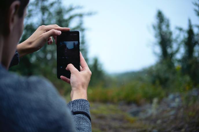
Earth Observation data comes from both space and here on the ground. As to the space side of the equation, this is done via satellites, such as Europe’s Copernicus Earth Observation Programme(opens in new window). But here on Earth, this data is gathered not only by trained professionals, but also by ‘citizen scientists’ who, collectively, contribute to citizen observatories. “Citizen observatories are community-driven initiatives that use a range of mobile and web-based applications to gather data on the local environment,” says Inian Moorthy, a researcher at the International Institute for Applied Systems Analysis(opens in new window) (IIASA) in Austria. “Not only do citizen scientists play a key role in land use and land cover monitoring, the data they collect helps direct environmental decision making.” IIASA is the lead partner in the EU-funded LANDSENSE (A Citizen Observatory and Innovation Marketplace for Land Use and Land Cover Monitoring) project. The project is dedicated to creating both low-cost methods for acquiring high-quality in situ data and high-accuracy environmental monitoring products. “Positioned at the crossroads of Earth Observation and citizen science, LANDSENSE creates marketable solutions that represent a step change in environmental monitoring activities in Europe – and beyond,” adds Moorthy.
Monitoring critical bird habitats
The project organised demonstration pilots in Vienna, Toulouse, Amsterdam, Indonesia, Serbia and Spain. For example, together with BirdLife International(opens in new window), LANDSENSE developed Natura Alert(opens in new window), an application for reporting threats to key bird habitats. Using the application, citizen scientists can report on the state of some of the world’s most vulnerable Important Bird and Biodiversity Areas(opens in new window) (IBAs), Key Biodiversity Areas(opens in new window) (KBAs) and Natura 2000(opens in new window) sites. The application was recently used to monitor critical habitats on the Indonesian island of Flores. The BirdLife partner in Indonesia used Natura Alert to take pictures and capture timely and geolocated information about forest change. This data is then used to validate alerts derived from the analysis of satellite images. “Such information is incredibly valuable for uncovering threats to forest ecosystems in an automated way,” says Sofia Capellan from BirdLife International. BirdLife is currently working across 469 IBAs in Spain and aims to scale the app to Greece and the Netherlands. All the collected data will be used to produce regional and global site monitoring assessments. These will be made available to researchers and practitioners around the globe, as well as private sector institutions and stakeholders who want to use high-quality data to make better decisions. “By combining Earth Observation with our network of volunteers on the ground, Natura Alert has the potential to revolutionise the way we monitor threats to biodiversity and prevent further habitat loss,” adds Capellan. “LANDSENSE gave us the opportunity to experience this potential first-hand.”
Integrating crowdsourced information
In France, LANDSENSE worked with the French National Institute of Geographic and Forest Information(opens in new window) (IGN) to develop a solution that enables users to help update the agency’s authoritative land use/land cover database. Called Paysages(opens in new window), this application integrates crowdsourced information with Earth Observation-based data. “Traditionally, changes to mining, construction and agricultural sites would only be picked up by professional surveys, which are expensive and are thus not carried out very frequently,” says Ana-Maria Olteanu-Raimond from IGN. “By combining both Earth Observation and crowdsourced information, Paysages helps us collect useful information for updating our authoritative database and makes our job easier.” Olteanu-Raimond says that IGN is currently upgrading Paysages based on feedback gained during the LANDSENSE pilot.