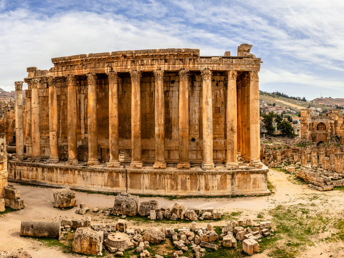
Uncovering the secrets of Roman desert fortifications
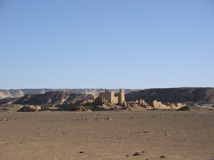
In the fourth century AD, the Roman Empire constructed a series of forts and fortified settlements in the Kharga Oasis, in Egypt’s Western Desert. These structures were strategically positioned to intercept caravan routes entering and departing the oasis. “The architecture of all these settlements is very similar. Many consist of a compact settlement built around a central, fort-like building, endowed with tall walls, square or round towers, and rows of vaulted rooms around a central courtyard,” explains Corinna Rossi, associate professor of Egyptology at the Polytechnic University of Milan(opens in new window). These frontier settlements also used agricultural systems and large-scale irrigation techniques based on the construction of very long ‘qanawat’. This system of underground conduits is very efficient in arid environments such as oasis outskirts, and would have required significant efforts to build. “This suggests the involvement of a centralised power, rather than the personal initiative of small local communities,” says Rossi. “All this points to a large-scale programme of exploitation of the area, in terms of both land use and control over the caravan routes.” In the L.I.F.E.(opens in new window) project, funded by the European Research Council(opens in new window), Rossi and her team investigated some of these settlements to understand more about Roman occupation strategies in this desert realm.
Investigating Umm al-Dabadib
The intention of the L.I.F.E. team was to start the first archaeological excavation event at the settlement of Umm al-Dabadib(opens in new window). However, shortly after the project started, Egyptian authorities restricted access to the entire Western Desert due to security concerns. To overcome this challenge, the team decided to analyse the site remotely, as if prodding it with immaterial antennae. They combined all the available information with a 3D model of the settlement and created a complex data set to be studied from multiple points of view. Through a metrological study of the ruins, the team discovered that these Late Roman buildings were constructed based on the ancient Egyptian unit of measurement, the cubit. This finding provided the latest evidence of the cubit’s use in construction, extending its known usage up to the fourth century AD. With this new understanding of the geometry of the Late Roman buildings, the researchers developed an innovative method to make spatial hypotheses about the buried portions. Eventually, when the desert reopened for a season, the team’s targeted excavations confirmed the theories created from remote analysis. To investigate remotely the surroundings of the settlement, “we made extensive use of satellite images and managed to reconstruct the movements of people and objects across the Kharga Oasis and the Western Desert in general and to identify the actual, unexpectedly large extent of the mining areas that dotted the oasis,” explains Rossi. “That probably represented a very important element of the discourse in antiquity – more than was thought until now,” she adds.
Strategy of control over the desert routes
The project’s most significant practical result was to demonstrate how the Roman authorities customised their approach to controlling the Empire’s borders based on the specific characteristics of each location. Officers familiar with the region, its terrain and available resources were entrusted with implementing large-scale operations, which relied on and directly involved the local population – likely a widespread process across the desert frontier. “It seems that the Roman authorities drew a large-scale plan to revitalise the oasis’ agricultural potential and especially to exploit its mineral resources,” says Rossi. “The military control of the crossroad must have played an important role, but was not the only reason behind this major strategic operation.”