AI helps preserve European cultural heritage

Stretching from the dawn of civilisation until today, Europe’s heritage sites both represent and celebrate its joint history and shared ideals. However, the impact of a changing climate and other factors on these cultural treasures can be difficult to fully understand and measure. “The HYPERION project has developed innovative tools for building resilience of historic areas in social, environmental and economic terms. These digital innovations will proactively enhance our knowledge to better cope with future disasters.” explains project coordinator Dr Angelos Amditis, Research and Development Director of the Institute of Communication and Computer Systems of the National Technical University of Athens.
Vulnerable heritage
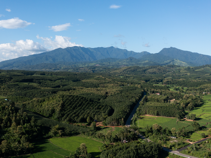
The reason for investing almost EUR 6 million in the project quickly becomes clear upon considering the nature of ancient monuments that the project has focused on. The chosen sites are particularly vulnerable to environmental threats such as extreme weather events, earthquakes and volcanic eruptions. HYPERION was therefore aimed at testing and better understanding the effects of extreme weather conditions, the ravages of time and intense geological phenomena on cultural heritage monuments through pilots conducted in Rhodes (Greece), Venice (Italy), Tønsberg (Norway) and Granada (Spain). The research team conducted atmospheric modelling to determine site-specific severity criteria in relation to climatic stressors. The main meteorological parameters used were wind speed and direction, ambient temperature, relative humidity and precipitation. Previously collated climate data were obtained from the EURO-CORDEX(opens in new window) archive, an internationally coordinated framework to produce improved regional climate change projections for all land regions worldwide.
AI helps researchers detect and analyse threats to historical monuments and sites
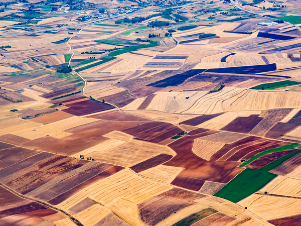
The HYPERION team incorporated information from different sources such as literature, surveys and satellite images and in situ sensors. This made it possible to determine more accurately the structural make-up of heritage sites and the associated uncertainties, as well as the impact of climate change. Researchers placed sensors at historic monuments and cultural heritage sites and employed vehicle-based drones, wide-area satellite services and community engagement tools to improve data acquisition. Artificial intelligence played an important role by automatically identifying conditions through ground multi/hyper-spectral imaging analysis techniques. The project successfully generated very high-resolution satellite images by employing state-of-the-art unsupervised and supervised deep learning (DL) models based on convolutional neural networks (artificial intelligence models specialized in recognizing and interpreting visual patterns). The images were sourced from various satellites, covering an area ranging from approximately 17 to 33 km2 and were crucial for detecting changes in land and cover at the project’s four study sites. The use of AI has simplified the process of change detection, allowing HYPERION to identify the presence of impervious materials like asphalt or concrete, which hinder the absorption of rainwater and increase the risk of pluvial flooding. Therefore, AI allows the automation of an otherwise human-intensive task, making the application of this technology feasible and enabling continuous monitoring and not just intermittent assessments.
Community engagement and future policymaking
However, according to Dr Amditis the heart of the project was the development of the Holistic Resilience Assessment Platform. “The HYPERION platform allows for integration of various analysis and modelling tools. Such an essential tool can efficiently support the local authorities in taking informed and faster decisions for the sustainable reconstruction of historic areas,” he explains. Another tool developed through the course of the project and embedded in the HYPERION platform is the Community Engagement Tool, available as a mobile application. Using the Community engagement tool, residents and visitors of historic cities, can photograph signs of damages to cultural heritage sites, pin and share them live on a global map and assist in the reporting of potential dangers to Europe’s cultural heritage assets. “HYPERION’s platform can assist Cultural Heritage experts in understanding the effect of previous restoration processes and in taking decisions to avoid material degradation phenomena and enhance resilience of our monuments,” concludes Dr Amditis, stating that this one of the most critical results of the project.