

Dual-LiDAR technologies optimise offshore wind park development and reduce risks
The aim is to revolutionise offshore wind resource assessment by developing the first commercial product: a modular floating LiDAR system that integrates both scanning and vertical profiling LiDAR technologies with advanced data processing.
Jordi Puigcorbe, NEOWIND project coordinator
The world is in urgent need of affordable green energy solutions. Throughout Europe, research institutions and SMEs are pooling their resources and ingenuity to deliver viable alternatives to fossil fuels. With funding from the EU through Horizon Europe(opens in new window), CDTI(opens in new window) and DLR(opens in new window), the Spanish company EOLOS(opens in new window) and the German company sowento(opens in new window) collaborated with the Stuttgart Wind Energy team at the University of Stuttgart(opens in new window) on the NEOWIND project to develop a LiDAR modular system (LMS) that is set to become a game-changing technology for site assessment for offshore wind farms.
Synergy of SMEs and research institutions
The NEOWIND team includes sowento, an independent engineering consultancy. The company’s main business fields are control engineering, software and wind energy applications – specifically LiDAR and floating offshore wind technology. Stuttgart Wind Energy SWE(opens in new window) is engaged in a variety of national and international research projects, covering development, prototyping and field testing of scanning LiDAR devices, turbine control, offshore load analysis, full scale data validation, floating wind turbine dynamics, design and standardisation. The NEOWIND partnership between EOLOS, sowento and SWE was highly complementary and brought all expertise together under one umbrella. “The collaboration effectively combined SWE’s unique scanning LiDAR hardware, sowento’s world-class software development capabilities and EOLOS’s systems engineering and marine operations know-how. Together, this interdisciplinary collaboration and results-driven approach have been key to the success of the project,” explains project coordinator Jordi Puigcorbe.
Developing the LiDAR modular system
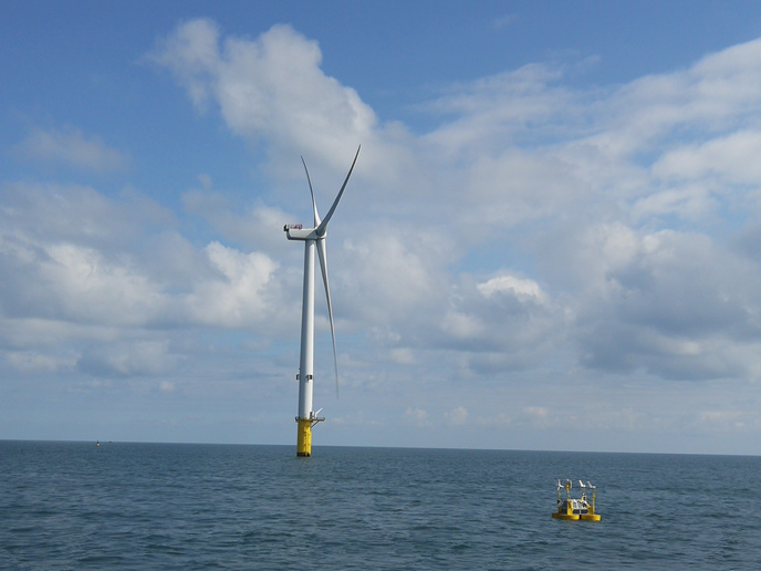
LiDAR (light detection and ranging) uses lasers to measure how the frequency of light changes after reflecting off particles in the air. From this change, known as the Doppler effect, wind speed and direction can be determined. The goal of NEOWIND’s LMS is to collect accurate wind measurements from LiDAR equipment installed on any type of floating platform, such as a boat or an EOLOS buoy. Floating platforms present unique challenges to LiDAR measurements because the roll and pitch of the platform can introduce bias to the measurement data. NEOWIND developed advanced algorithms to compensate for the effects of the platform’s motion and to integrate signals from multiple LiDARs in the same platform. The sowento-designed software is able to incorporate in real time the movement of the buoy and compensate for its effect on the measurements of the wind speed and direction. The LMS is capable of accurately capturing the wind direction and turbulence, and the project validated its solution in real-world measurement campaigns in the port of Rotterdam and next to a meteorological mast(opens in new window) in the North Sea.
A roadmap to commercialisation
By project closure, NEOWIND had achieved all of its objectives. The LMS vastly increased accuracy compared to state-of-the-art wind data processing tools. It is capable of integrating different LiDAR technologies deployable via diverse floating platform types, and it is a valuable tool in all offshore wind project phases (development, construction and operation). In particular, the testing of combined vertical profiling and scanning LiDAR in the same buoy prototype has been very successful. These encouraging results have led to further funding from CETPartnership(opens in new window) for ongoing research and development. As Puigcorbe shares: “The aim is to revolutionise offshore wind resource assessment by developing the first commercial product: a modular floating LiDAR system that integrates both scanning and vertical profiling LiDAR technologies with advanced data processing.” These advances will support the wind energy market by giving producers the information they need to position wind farms for optimal performance. The consortium brought together EOLOS, sowento and Stuttgart Wind Energy, co-funded by Horizon Europe, the Spanish Centre for the Development of Technology and Innovation (CDTI) and the German Aerospace Center (DLR).