Holographic system supports Europe’s response to climate change emergencies


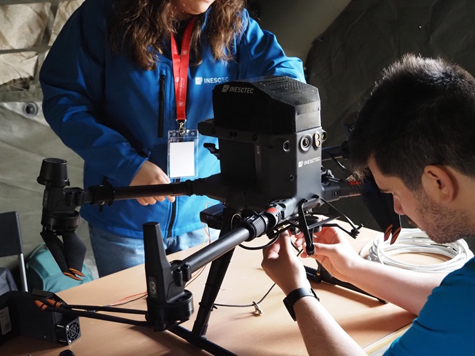
The impacts of climate change are already being felt keenly across Europe. Warming temperatures are increasing both the frequency and severity of climate-related disasters, such as flooding and wildfires, and citizens’ lives are increasingly at risk. Response and recovery teams face several critical challenges. A lack of real-time situational awareness about unfolding events means decision-making is slow and resources are allocated inefficiently. Communication systems can also fail during extreme events, through disruptions from blackouts, damaged infrastructure or network congestion. Coordination across various European agencies is also complex, making it difficult to build a unified operational picture. “Additionally, reconnaissance missions can be dangerous for personnel, especially in unstable or inaccessible environments,” explains project coordinator Vanina Fissore, from the Italian innovation SME Ithaca(opens in new window). “Many of these tasks could be performed safely using unmanned systems.” The OVERWATCH(opens in new window) project designed a new integrated system to address these challenges. The project combines Earth Observation data from satellites and drones, processing by artificial intelligence tools, and resilient communication through fallback networks supplied by tethered drones. It also supports real-time, rapid decision-making with immersive visualisation tools, while enhancing the safety and efficiency of first responders through autonomous reconnaissance. “By integrating data from satellites and drones, and presenting it through intuitive interfaces such as web dashboards and augmented reality, the system helps teams better understand evolving conditions on the ground,” says Fissore.
Trialling the system through real-world challenges
The OVERWATCH consortium designed and developed the system, which also includes a holographic/augmented reality (AR) element operating on specialised visors to support response efforts on the ground. “The AR component enables firefighters and civil protection commanders to visualise the same information available on the web dashboard – such as live maps, fire perimeters, drone positions and flood data – directly overlaid onto their physical surroundings,” adds Fissore. “Instead of relying on fragmented and delayed information, commanders can access a clearer, real-time picture of the situation, enabling faster and more informed decisions.” The system was trialled and demonstrated in real-world scenarios: a wildfire exercise in Portugal and a system tools demonstration in Poland. During these activities, practitioners and end users were able to test the full system, including all platform functionalities and the AR interface.
Supporting Europe’s resilience against climate change
Two demonstration events, held in Portugal in October 2025 (on wildfires) and in Poland in March 2026 (on floods), were also a key part of this achievement. These events brought together civil protection agencies, military units and emergency responders from diverse countries to exchange knowledge and operational experience. The researchers will continue to refine the system, incorporating vital user feedback. To this end, the team launched a free 30-day trial in March 2026, allowing emergency management agencies, and all interested users, to gain hands-on experience with the platform. “In the longer term, the hope is that platforms like OVERWATCH will strengthen Europe’s overall resilience to climate-related disasters by improving coordination across agencies and countries, supporting more proactive emergency management, and ultimately helping to reduce the impact of these events on people, infrastructure and the environment,” says Fissore.