Cross border marine reserves for East Africa
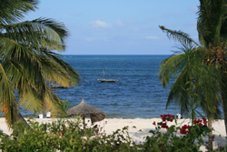
A baseline was defined in order to identify knowledge gaps and avoid duplication of work. Determining the base line involved the gathering of existing information and databases and the mapping of habitat types and the use of coastal areas both on land and at sea. A biophysical analysis was also conducted to pinpoint areas of high biodiversity and to identify species and habitats that were particularly important for conservation. Researchers carried out a socioeconomic study to identify and evaluate the sources of income available to local communities from natural resources and current socioeconomic requirements. This was conducted using regional, national and local analyses. Project partners examined the issue of governance assessing the institutional, legal and policy frameworks for creating and managing MPAs. Research was also carried out into harmonising the different frameworks for the creation of cross-border development plans. Alternative MPA scenarios were also studied involving different geographical areas and a range of conservation targets. Information collated by the Transmap project was used to produce thematic Geographic Information System (GIS) maps of the study area and included maps of different types of coastal habitat based on satellite remote sensing. This work enabled users to observe changes to a range of ecosystems, geographical features, and political and administrative boundaries. Transmap has provided a baseline for future research initiatives and policy recommendations that will help in the design of a cross-border network of reserves throughout East Africa. These reserves will bestow major benefits on both the natural environment of the region and the local population.