Better monitoring of crops in continental Europe
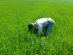
Droughts in the United States, frosts in Russia, extreme weather in Australia the weather conditions have a critical impact on crop yields around the world. Government services, food relief agencies and international organisations monitoring world food production and trade require better information to plan ahead in the event of shortages. This is where remote sensing data, using high-temporal resolution satellite imaging, can help by providing information on crop area and growth in significant areas, such as Russia's oblasts. Winter crops are especially affected by prolonged low winter temperatures. Indeed, a feature of cultivation of winterwheat is that its growth starts in autumn and proceeds again in spring after a dormant period in winter. The problem is that the models used for monitoring winter wheat growth are not calibrated for continental climates. Moreover, the WOFOST crop model used as part of Europe's 'MARS crop yield forecasting system' (MCYFS) needs to be tailored for the effect of frost damage. The EU-funded project 'Monitoring crops in continental climates through assimilation of satellite information' (MOCCCASIN)set out in 2010 to fill this gap. Their work involves collecting field data on Russian winterwheat varieties and growth conditions, and then mapping the season's winterwheat fields using satellite data. The team was also tasked with reviewing the current models that simulate the impact of frost on winterwheat. Other partners sought to assimilate data on crop biophysical variables (actual plantvegetation information), retrieved from satellite timeseries observations, into the WOFOST model. significant progress has been made. This includes a database of the biophysical properties of Russian wheat cultivars, a time series of wintercrop masks for Tula region with an accuracy of 82%,and new components for frost impact modelling. Towards the end of the project(mid-2013), the researchers predict they will have improved methods for assessing frost damage and winter kill in continental climates. This stands to benefit Europe's Global Monitoring for Environment and Security (GMES) land cover monitoring core services on agriculture, which should lead to improved cropyield monitoring and modelling. as part of global Earth Observation activities (i.e. Global Earth Observation System of Systems (GEOSS)), MOCCCASIN's work contributes to overall agricultural risk assessment. The ability to better capture the changes in croplands and monitor global agricultural production results in more accurate and timely reporting of national agricultural statistics. Suchdata can provide accurate forecasting of potential crop failures that may lead to shortfalls in the world's food supply.