

JRC outlines tsunami information gathering role
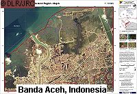
The European Commission's Joint Research Centre (JRC) has outlined the contribution that it has been making to assessing the impact of the Indian Ocean tsunami. The JRC has been working with other organisations, such as United Nations agencies, the European Space Agency, national agencies, EURIMAGE, NASA satellite data providers and space companies, to measure the extent and impact of the disaster using satellite analysis. Immediately following the tsunami, the JRC was involved in analysing regional maps depicting flooded zones and affected populations. 'A preliminary estimate of the inundation zone was produced by calculating the area of less than 10m and 20m elevation contour lines within 5km of the coastline for the entire region,' reads a Commission statement. 'This information was cross-checked with global population density data to estimate the likely population affected. Regional land cover maps were used to estimate impact on natural resources.' The JRC then acquired information and data through open sources and produced thematic country scale maps showing affected populations, infrastructure and natural resources. It has also been involved in analysing damage on a smaller scale, within each affected country. The JRC's work in relation to the tsunami is far from over. Damage analyses and situation assessments will be further developed, and a comprehensive tsunami information system will be maintained by the JRC. The centre will also participate in an assessment of the strengths and weaknesses of European and international mapping and satellite tools intended for such situations.