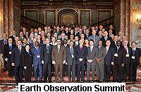
Observing the Earth on a global scale - 60 countries endorse implementation plan
Ministers and delegations from around 60 countries descended on Brussels on 16 February to sign up to a ten year implementation plan for the global Earth observation system of systems (GEOSS). The idea of such a system has gained rapid interest. The number of countries wanting to be involved has doubled from 30 to 60, and around 40 international organisations are also participating. 'It exists because everybody is beginning to recognise the value of such a system. We are entering a new era in understanding the Earth and using it for everyone's benefit,' said Vice Admiral Conrad Lautenbacher, Under Secretary of Commerce for Oceans and Atmosphere in the US, who co-chairs the GEO with the European Commission's Research Director-General, Achilleas Mitsos. GEOSS will build on existing Earth observation systems by coordinating their efforts, addressing gaps, supporting interoperability, sharing information and reaching a common understanding of user requirements. It will also improve the delivery of information to those that need it. 'The vision for GEOSS is to realise a future wherein decisions and actions for the benefit of humankind are informed by coordinated, comprehensive and sustained Earth observations and information,' states the ten year implementation plan. The plan sets out a timescale for achieving certain objectives in the fields of improved Earth monitoring, understanding of Earth processes and prediction capabilities for the behaviour of Earth systems. For example, within two years, a mechanism will be established for coordinating user needs across the various societal benefit areas. Within six years, GEOSS will put in place international information sharing and dissemination. In ten years, the system will provide timely data and products for local, national, regional and international policy makers. The areas to benefit are listed as: disaster mitigation and management; health; energy; climate; water; weather; ecosystems; agriculture and biodiversity. While participation in GEOSS is completely voluntary, the partners recognise that some commitment is necessary in order for the 'system of systems' to function. The ten year implementation plan underlines this fact, stating: 'The success of GEOSS will depend on data and information providers accepting and implementing a set of interoperability arrangements, including technical specifications for collecting, processing, storing, and disseminating shared data, metadata, and products.' Research is to receive a boost through GEOSS. The group will push for further research into instrumentation and system designs for airborne and space-based observation, data management and information fusion, and data assimilation modules. One of the goals of GEOSS is capacity building in developing countries. The system is based on a concept of 'global partnership between those whose capacity needs development and those who are able to assist in the process, recognising that activities have intertwined social, environmental, and economic impacts.' South Africa's Minister for Science and Technology, Mosibudi Mangena, welcomed the involvement of developing countries in the initiative, and said that his country will use the data generated for development and to attack poverty. A challenge for his and other developing countries is first and foremost to coordinate all the data-collecting bodies that currently exist, said the minister. Indonesia's Minister for Research and Technology, Kusmayanto Kadiman, was equally pleased to be involved in GEOSS. He highlighted in particular how his country will benefit from tsunami and multi-hazard warning systems that are to be supported through GEOSS. Asked about the benefits for his country, Dr Kadiman highlighted that the data that his country will receive will be almost real time. 'We can make more precise models and give a proper warning so we can minimise the number of victims,' he said. This point was picked up by EU Science and Research Commissioner Janez Potocnik in his video message to the Earth observation summit. 'The tsunami disaster has shown us just how important Earth observation can be, by providing invaluable data to support the immediate humanitarian response and now reconstruction. Global problems need global solutions,' he said.


