Reconstructing the paths of Roman travellers from Italy to Serbia
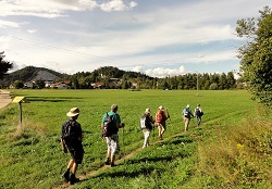
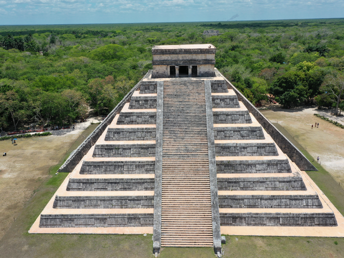
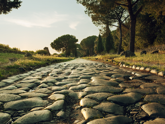
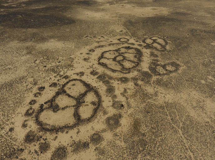
An EU-funded project has marked a research first in considering, as a whole, a particular Roman route along the river Sava. The team mapped the Roman itinerary on the ground as well as connected archaeological sites, offering new information and understanding of this particular archaeological legacy. The core goal of the RecRoad(opens in new window) project was to map and reconstruct the paths of Roman travellers from Aquileia in north-east Italy to Singidunum – an ancient city known today as Belgrade, Serbia’s capital. The river Sava originates in the Julian Alps of Slovenia, flowing through central and south-east Europe and draining into the Danube in Belgrade. This Roman route along the river Sava was in the past considered a secondary route, albeit the first established by the Romans in the first century BC. “Many parts of this itinerary had been almost forgotten by the archaeological research, due to the political situation of the Balkan region and to the lack of field research,” notes Professor Francis Tassaux, project coordinator. Mapping the roads, their remains and nearby archaeological sites targeted a better understanding of the relationship between the Roman roads and surrounding landscape. Research aimed to determine the degree of reliability of information currently available. Setting the maps of history straight, the high-tech way Satellite remote sensing analysis identified and confirmed the presence of 12 archaeological sites in Serbia, in the region of Sremska Mitrovica, where 70 km of the Roman road were surveyed in six days. Although some of these had already been found in another archaeological survey, their exact location had never been mapped. Overall, RecRoad reviewed the definition and description of 475 archaeological sites along the path from and through Italy, Slovenia, Croatia, Bosnia and Herzegovina, and Serbia. Besides the study of published works, historical map cadastres, surveys showing land boundaries, were geo-referenced and imported in the GIS system built to map the Roman itinerary. RecRoad was the first archaeological research project that used Sentinel-2 images to detect the presence of archaeological buried remains. Project activities made it possible to define a methodology for exploiting these free satellite images, produced by the European Space Agency, in an archaeological context. A publication is currently being prepared on the methodology developed to process the Sentinel-2 images. Generally, the research methodology developed and tested within RecRoad opens the way to new inquiries into the Roman roads’ network. The structure of the geographical information defined for the RecRoad project has been used for the recently commenced AquitaViae project, which aims to map the Roman roads of the province of Aquitania. A dissemination strategy on the road, literally Project results have been partially published and disseminated through various actions, including public presentations and international conferences. Most notable, however, is one dissemination event involving a project hike with the lead researcher, along the reconstructed Roman itinerary from Aquileia in Italy through Slovenia, Croatia, Bosnia and Herzegovina, to Belgrade, Serbia. The small group told the route’s story, explained the project’s research methods, and spread knowledge of the shared archaeological heritage in a geographical region still heavily marked by recent wars. Tassaux notes two other major project achievements. The first concerns the creation and development of a network of cooperation between Croatia, France, Italy, Serbia and Slovenia regarding the renewed study on roads and, more generally, cartography and historical geography. This will mobilise new media of research and dissemination, provided by databases, geomatics and web mapping. Last, the project’s lead researcher exhibited great expertise in analyses and exploitation of the satellite images. “Her methodology,” the professor states, “deserves to be diffused, particularly as it can be applied in other regions, in other periods and on other themes.” “We often think that we know everything that we need to know about Roman roads. But this is not true,” offers Tassaux. “It is important to understand precisely where a road passed, even in the periphery of the Empire, to better unravel the relationship involving the Roman roads and the natural and human elements of the landscape,” he adds. RecRoad outcomes contribute to ongoing discussion as well as new knowledge in this field.