Mapping out a new way to preserve Europe’s cultural heritage
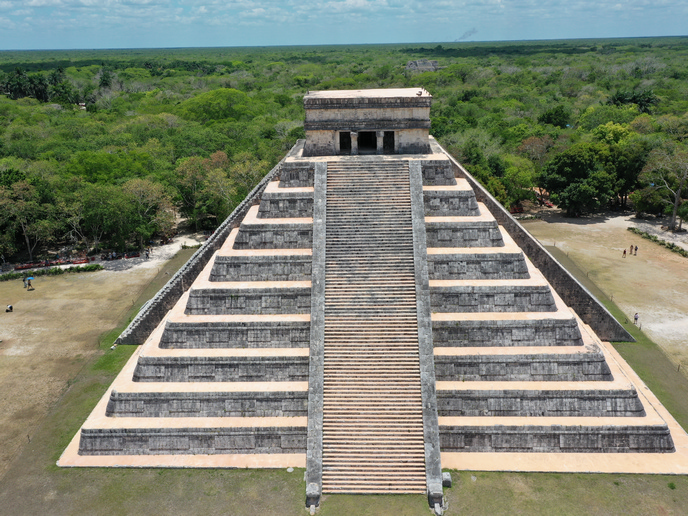
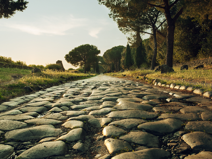
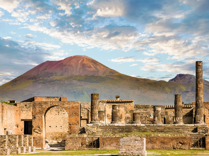
Europe’s rich cultural heritage(opens in new window) is at risk, with many important archaeological sites being threatened by soil erosion, land movement and land use change. The good news is that archaeologists now have access to a range of emerging technologies. Solutions such as Earth observation (EO), geographic information systems (GISs), unmanned aerial vehicles (UAVs) and geophysics all have the potential to help archaeologists better protect our cultural heritage. Putting these technologies together is the EU-funded RESEARCH(opens in new window) project. “The RESEARCH platform was designed to be an affordable tool that archaeologists and authorities can use to monitor sites for signs of degradation, implement preventive maintenance, reduce restoration costs and, ultimately, preserve our cultural heritage for future generations,” says Fabiana Battistin(opens in new window), a postdoc in Classical Archaeology at the University of Tuscia(opens in new window) (Unitus) who served as the project’s scientific technical manager.
Automating the risk assessment process
At the heart of the project, which received support from the Marie Skłodowska-Curie Actions(opens in new window) programme, is a multitask GIS thematic platform equipped with a range of specifically developed plug-in capabilities. But behind this platform is an enormous amount of research. To start, researchers assessed the intensity of a threat using different types of satellite and ground data, along with data acquired using UAVs. This data was then analysed and used to map the various hazards facing an archaeological site or feature. The project also used aerial and terrestrial remote sensing data, including data collected via ground-penetrating radar (GPR), to detect and map both the standing structure itself and its subsurface archaeological features. “These maps allowed us to understand how vulnerable each particular structural feature was against any specific hazard,” explains Stefano De Angeli(opens in new window), associate professor of Classical Archaeology at Unitus and RESEARCH project coordinator. All these data processing and mapping capabilities were then integrated into the comprehensive RESEARCH platform. “This platform automates the entire risk assessment process, resulting in hazard, vulnerability and risk maps that government authorities and other stakeholders can use to make data-driven decisions about how best to protect our cultural heritage,” adds Battistin.
Using Earth observation and geophysics to monitor and preserve cultural heritage
The RESEARCH project also looked at how different types of EO data, including that coming from Copernicus(opens in new window), Europe’s very own EO programme, in combination with geophysical data, could be used to monitor and preserve cultural heritage. For example, the project created a plug-in solution that automates the post-processing of GPR data and creates an intermediate vulnerability map of buried archaeological deposits. “This demonstrates the possibility of modelling subsurface archaeological features from GPR data by using GIS. Doing so opens the door to developing a solution capable of creating full 3D models of these structures,” remarks De Angeli.
A step change in archaeological preservation
By experimenting with new technologies and using them to assess and map various risks, the RESEARCH project represents a step change in archaeological preservation. “The tools developed during the project enable authorities to proactively protect archaeological sites by implementing ongoing monitoring and a long-term risk mitigation strategy,” notes De Angeli. “Our work will further ensure a more efficient use of EO data, along with all the new emerging technologies, for the monitoring of the most important risk factors, as well as for archaeological mapping and interpretation,” concludes Battistin. The project’s results could also serve as the basis for developing best practices for protecting those archaeological landscapes and sites most vulnerable to the effects of climate change.