Search and rescue drone
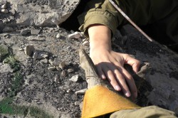
Following disasters such as earthquakes or bombs, survivors are often buried under rubble. Technological solutions for finding victims have had limited success. Video-search systems can find survivors if they are uncovered. Ground-penetrating radar is able to locate victims buried less than 50 cm. More powerful forms of radar penetrate more deeply, but such systems are expensive and too heavy for field use. Mobile signals The EU-funded MOBNET(opens in new window) consortium developed and tested a new prototype search and rescue system. It consists of a 5 kg electronic payload currently mounted on a drone aircraft, which could also be mounted on helicopters. The payload detects and pinpoints mobile phone signals. The concept relies on the fact that almost everyone in Europe carries a mobile phone. These devices are fairly tough, especially inside modern cases, and are likely to continue transmitting a carrier wave although buried. To minimise the power needs of mobile devices, networks are divided into cells, each with a powerful base transceiver station (BTS). As phones move between cells, networks utilise some simple positioning parameters, including signal strength and time of arrival, to locate the devices to particular cells. Locating buried phones is much more complicated. “One of the main problems when locating cellular phones in rubble piles is the behaviour of the electromagnetic waves,” says project leader and director of technologies at Orbital Critical Systems, Luis Ramírez. “Signals are weak, and echoes give a false position.” Advanced algorithms MOBNET’s new algorithms sort out the signals. The payload emulates a BTS. As it flies around the disaster site, it tries to connect with mobile phones. The project’s algorithms use the same parameters as a conventional BTS to calculate the distance between the drone and the phone, a lot more accurately. The system interfaces with European Global Navigation Satellite Systems to provide a precise physical location of the order of centimetres. Seek and Find The research team expects that when a disaster occurs, rescuers would quickly establish a base station to coordinate search operations. The drone could be airborne less than five minutes later. It would have to fly over the affected area in a particular pattern for the algorithm to obtain best results. When the payload detects a mobile device, the calculated position would be sent to the base station. That could be a laptop or tablet using the project’s ground station software, which maps the location of the detected mobiles in real time. “During the first 10 minutes of flight, if any mobile phone is under the coverage area, it will be detected,” adds Ramírez. Project development of the physical components and algorithms proved successful. Testing has also been promising, even during the harshest conditions of summer and winter. The prototype demonstrated its core functionality. Subsequent projects will involve development of a commercial product from the prototype. This stage will refine the performance and add new features, some of which may be applicable beyond the initial goal of search and rescue. The MOBNET system will bring a new level of capability for locating people in trouble.