

Satellite-supported sensors target safer roads
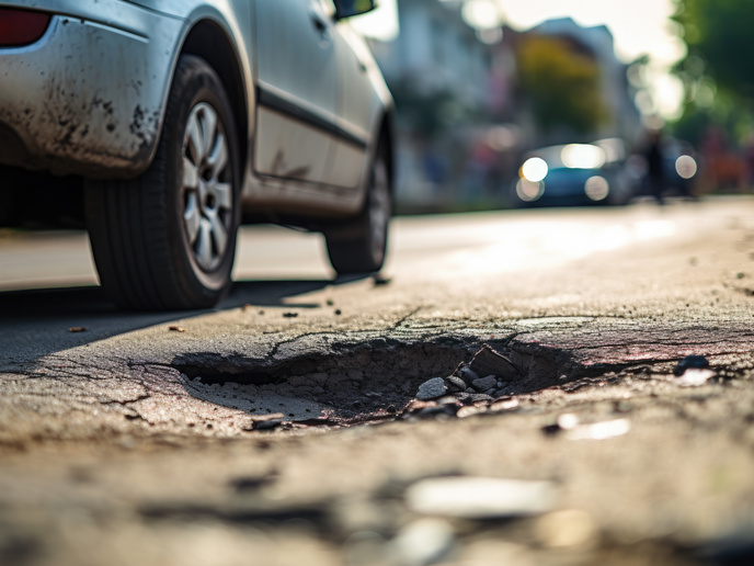
Overuse of road surfaces inevitably contributes to their degradation, leading to safety risks for users. The problem is especially acute in harsh weather conditions. An ability to identify problematic road surfaces early could help to alert road users and encourage them to use other routes, and also enable authorities to implement maintenance works in an efficient and optimal manner.
Development and installation of vehicle sensors
The EU-funded ESRIUM(opens in new window) project sought to achieve these aims through the development and installation of vehicle sensors. The concept is that these sensors feed data to create a digital road surface damage map, supported by satellite positioning. “The project was inspired by the capabilities of the European Global Navigation Satellite System(opens in new window) (EGNSS) for precision vehicle geo-localisation and vehicle autonomy,” explains project coordinator Matthias Ruether from Joanneum Research(opens in new window) in Austria. “Once it is possible to precisely determine the in-lane and cross-lane position of autonomous and semi-autonomous vehicles, these vehicles can slightly alter their path to avoid even very small changes in road surface quality. In ESRIUM we sought to create the data basis for such optimisation strategies, and to demonstrate the benefits for safety and resource efficiency on the road.” Novel mid-priced sensor systems for detecting road damage were selected for affordability. A platform was developed for broadcasting precision routing recommendations and potentially dangerous locations to automated car and truck fleets in a user-friendly way, as well as to road maintenance authorities.
Tested in urban and motorway environments
The project’s prototype low-cost sensor systems were mounted on vehicles and tested in urban and motorway environments. Algorithms used the data collected to detect and classify road damage. Satellite positioning enabled the exact location of each reported damage site to be pinpointed. “Vehicle fleets carried a low-cost sensor system that continuously monitored the road surface,” says Ruether. “This sensor information was converted to road quality information using AI methods. This information can then be directly observed as a digital map, for example by being directly overlaid on OpenStreetMap(opens in new window).” This digital map of road surface damage contains locations on the road that should be avoided. AI methods were also used to predict how road quality might further deteriorate over time, information that is valuable for road maintenance planning.
An additional layer of safety and efficiency
The ESRIUM project was launched in anticipation of the widespread introduction of partly automated cars and truck fleets. The sensors were specifically designed to be easily installed, and to provide an additional layer of safety and efficiency. “A user acceptance study was conducted to identify potential pitfalls of market entry early on,” adds Ruether. Next steps include developing a production-ready version of the sensor system, and automating the complete workflow. The project consortium also plans to find ways of seamlessly integrating the final road wear map into everyday use, and extending the solution to cover rural and secondary roads. “We hope that a follow-up project will be launched shortly, to support the elevation of the technology maturity of these innovations,” remarks Ruether. “A further demonstration phase will help to convince the first customers to invest in the system and roll this out to the market.”