New models capture Earth’s climate at kilometre scale

Climate research has hitherto lacked the right tools to answer questions about what weather events are likely to occur when, where, and how often. The technology was simply not powerful enough to handle this complexity. “The key breakthrough is that new models can now bridge the gap between planetary-scale weather patterns, which traditional climate models focus on, and the smaller-scale motions that give rise to these patterns,” notes Bjorn Stevens, coordinator of the EU-funded NextGEMS(opens in new window) project. “Unlike older models that rely heavily on empirical approximations, these new simulations are better grounded in the physical laws of thermodynamics and fluid dynamics. This leap is made possible by massive advancements in computing power, fueled in part by the growing demands of AI.”
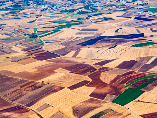
From global patterns to local impacts
For instance, it is now possible to simulate local wind patterns and ocean currents that help sustain many of Earth’s natural systems. Similarly, we can simulate rainstorms, including tropical cyclones, whose effects we previously either ignored or treated statistically. These storms have profound societal impacts as they can cause floods, damage infrastructure, and threaten lives. Another breakthrough is the ability to include ocean eddies in simulations. “These swirling circulation systems help balance the planet’s energy budget and influence the structure of the global ocean. They also interact with ice sheets, a process critical for understanding sea-level changes,” outlines Stevens. Beyond these large-scale phenomena, the new models can now also account for ever smaller, localised effects, such as microclimates created by complex topography, wind systems associated with fire-weather, or the cooling effects of sea breezes along coastlines.
Advancing knowledge of rainfall and cloud behaviour
NextGEMS developed two advanced storm-resolving models for use scientifically, and operationally, by Destination Earth. One was built on the ICON modelling framework and the other on the integrated forecast system of the ECMWF. These models demonstrate an impressive grid spacing – up to 1 km. The new models have other groundbreaking advantages: “They can be more easily compared to real-world measurements, especially data from the latest Earth Explorers satellites,” highlights Stevens. This makes them simpler to evaluate and improve, offering hope for a more accurate physical representation of the climate. Thanks to the computational power of EURO HPC, these models were used to explore a wide range of scientific questions. These include what controls tropical rainfall patterns, how clouds form and organise, how the climate responds to warming and aerosols, and how land-use changes affect precipitation. Key discoveries include the role of air-sea energy exchange in shaping tropical rainfall, a feedback loop between precipitation and soil moisture, how vertical mixing in stable conditions influences cloud distribution, and the role of ocean eddies in regulating the spatial pattern of global warming.
A synergy between high-resolution and simplified models
The new models excel at providing more physical predictions of how the climate will change over the next few decades. However, for longer time scales – centuries or millennia – the older, more statistical models remain indispensable. Being computationally simpler, they can run for longer to produce large ensembles, where the same calculation is repeated many times to better understand how much variability is intrinsic to the system itself. This makes them invaluable to efforts that try to understand long-term changes and decadal-scale variability. “A simple way to think about the new models is that they are designed to help us reason about local adaptation to climate change. The older models focus on globally averaged changes, which is useful for reasoning about mitigation strategies,” concludes Stevens.