Catching the wind; Doppler radar forecasts
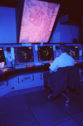
Doppler radars work by emitting high-frequency radio waves and detecting the waves reflected back to the radar by objects in the atmosphere, such as raindrops. In addition, radial winds (toward and away from the radar) can be determined by analysing changes in the frequency of the reflected signal owing to the Doppler effect. In order to provide high quality information about the three-dimensional wind field using data from just one Doppler radar, several assumptions must be made. Unfortunately these assumptions are often crude and cannot address many of the important weather phenomena that exist, particularly severe weather. Mathematicians at the University of Essex with an extensive background in Doppler radar research developed DARWIN: Doppler Analysis and Retrieval of Wind INformation. It tackles the challenge by merging radial wind data from complementary Doppler radars. By applying the continuity assumption it is possible to mathematically constrain the problem and to derive the three-dimensional wind field. The new model was encoded in a prototype software package, DARWIN. The software has a friendly Graphical User Interface (GUI) to help users input data from the two Doppler radars. The square-shaped area of interest is user-specified. Data visualisation tools are also incorporated. Finally, DARWIN was designed for real-time operation. The technology was tested in the field with radars operating in the Emilia Romagna region of Italy. The use of DARWIN requires two Doppler radars situated approximately eighty kilometers apart. Its primary application is for forecasting very strong winds associated with severe, convective storms. Potential users of DARWIN are national meteorological and civil defence services for providing advance warning to the public when such extreme events occur.