Integrating accurate brown-field assessment techniques
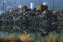
An EU funded project has focused on the development, testing and application of tools, technology and software for a detailed examination of brown-fields (contaminated and waste disposal) sites. Efficient and effective methods such as geophysical techniques and sampling and laboratory analysis were used to calibrate geophysical data. Researchers used an assessment approach based on sampling as well as thorough employment of combined non invasive geophysical surveys. These were used because they are expected to be more beneficial for producing detailed assessment reports and for reducing costs as compared to the conventional methods used. Defining the performance, limits, applicability conditions and costs of such techniques was also important. This is because it will prevent any inappropriate use of geophysical methods and assist end-users in maximising efforts related to financial support of the activities. The methodology they designed is the most convenient way to derive qualitative and quantitative readings from geophysical data that can be used to evaluate the condition of a brown-field. A calibration template is used to describe the optimal calibration methods and is set up specifically for each geophysical measurement. These calibration functions and evaluations of geophysical methods should be useful for scientific and professional communities and organisations. The project partners are interested in providing their expertise in research or consultancy activities in the future.