Space applications for environmental monitoring
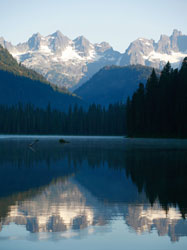
Snow and glaciers play an important role in the water cycle at high latitudes, as well as in mountainous regions and the river system they drain into. For estimating the amount and timing of snowmelt run-off from snow and glaciers in the mountainous areas of the Northern Europe numerous hydrological models have been developed. However, a major drawback to the use of these models has been the insufficient information available on the spatial and temporal distribution of their key parameters. By exploiting the unique potential of combining data from multiple sensors aboard ESA's environmental satellite ENVISAT, the ENVISNOW project sought to provide a better understanding of these complex Earth processes. Under the coordination of Norut Information Technology existing techniques were investigated and importantly, new multitemporal algorithms were proposed for the regional mapping of important input parameters for hydrological models. More specifically, Synthetic Aperture Radar (SAR) repeat pass imagery data was used to derive dry snow above areas with wet snow and thus, support the mapping of the whole snow-covered area. The use of weather and light-independent data from the Advanced Synthetic Aperture Radar (ASAR) allowed continuous coverage of both high spatial and temporal resolution, comparable to products of optical imagery. Furthermore, to improve the differentiation between wet snow characterised by low radar backscattering and dry snow or bare ground, air temperature data from meteorological station networks were required. High resolution surface air temperature maps were created and used to filter wet snow from reference images captured during cold, dry snow conditions and subtracted from the image to be processed. Maps of snow-covered mountainous areas of Southern Norway have been derived for the spring melt season and validated against images from the Medium Resolution Imaging Spectrometer (MERIS) and field observations. Finally, a production line for near real-time automated geocoding of ASAR images and classification of snow-covered areas was established for use in operational applications for sustainable management of the environment.