Satellites and snow in Scandinavia
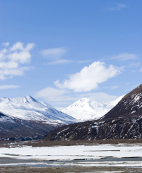
Snow's greatest impact often occurs when it melts. On the negative side, snowmelt can cause flooding, while on the positive side it can generate electricity in hydropower installations. In both cases, it helps to know how much water the snowpack contains, which is expressed as the Snow water equivalent (SWE). Observational data is not plentiful enough to enable mapping of SWE over large areas. For this reason, Norut IT in Norway and its partners in the ENVISNOW project looked for a way to exploit data obtained from European remote-sensing satellites (ERS). Scientists with the Norwegian research institute used scattering theory to establish a relationship between phase change and snow depth. Specifically, they applied a delta-K interferometric technique to Synthetic aperture radar (SAR) data. The approach was validated for dry snow conditions in both winter and summer. The result was a highly accurate estimate of SWE with spatial resolution in the order of 10 kilometres. The next phase of the research involves applying the new methodology to Advanced SAR (ASAR) Single look complex (SLC) data over northern Norway. Hydropower plant operators as well as flood and climate forecasters stand to benefit from these developments.