Monitoring landslide prone areas
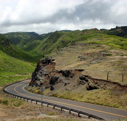
The impacts across the globe of extreme natural events such as landslides are enormous, and a serious handicap to the advancement of societies struggling to achieve sustainable development. Too often those at risk do not have proper early warning of the events nor are they properly equipped to respond to available warning information. Landslide hazard mitigation strategies should comprise a wide range of activities, including hazard zones mapping, real time monitoring and alert systems for active landslides, protective engineering measures and emergency planning. Against this background, the OASYS project sought to collect as much information as possible from different disciplines, which could be used within a knowledge-based system to define landslide risk. Due to the combination of topographical, geological and seismological conditions, landslides are a common phenomenon in Northern Greece, where the site investigated by project partner EGNATIA ODOS S.A. is located. The Greek test site 'Prinotopa' was identified as a landslide prone area from remote sensing data with the use of differential Synthetic Aperture Radar (SAR) interferometry. The geomorphology of the 'Prinotopa' landslide further indicated that in the past there had been landslides of significant extent and this was also confirmed by the available geological data. In a first step, geodetic deformation measurements were carried out to collect information on block movement and on the boundaries between stable and unstable areas. In the following step, high precision geotechnical measurements systems were installed across the boundaries between unstable areas moving with different velocities in different directions. This multisensor network, consisting of inclinometers, extensometers, piezometers and a rain gauge, was logging data continuously form 2002 to 2004, and therefore could support a real-time alert system. All the information collected was made available for use within the knowledge-based system proposed by the OASYS project to assess further development of the sliding area. This system could lead the practitioner from data acquisition to the definition of landslide risk and suggestions for risk management measures.