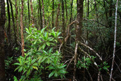
Studying wetlands in Africa
The National authority for remote sensing and space sciences (NARSS) in Egypt applied its expertise in remote sensing during the MELMARINA project. Landsat thermal mapper images were collected for three wetland sites: Lake Manzala in Egypt, Ghar el Melh in Tunisia and Merja Zerga in Morocco. NARSS used Ground control points (GCPs) and polynomial transformations to correct the images. Next, spectral analysis of the corrected images led to the definition of several distinct ecological zones. Following corroboration with field surveys, the data was used to investigate the spatial variation of vegetation between the three sites. A central focus of the MELMARINA research was to quantify changes in the expanse of the three wetland sites, in the distribution of vegetation and in major features (e.g. sea outlets, reclamation, etc.). In order to accomplish this task, NARSS substituted Aster and SPOT images as well as aerial photos when historical Landsat images were not available. Finally, the System for hydrology using land observation for model calibration (SHYLOC) software package was employed to provide information about water levels. The method was calibrated against field measurements of channel width on the Utique Plain in Tunisia. The knowledge obtained during MELMARINA will be used to formulate sustainable wetland management practices in the region.