New information system provides safe passage for ships
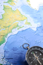
The 'Electronic pilot display and information system' (EPDIS) project developed new safety technologies for high speed craft and other types of vessels to help them navigate congested coastal waters. Researchers combined three and four dimensional (3D and 4D) geographical data from satellites with maritime navigation information to improve safety during voyages. Project partners developed a system for processing 3D geographical information including stereo satellite pictures and laser surveys. The data was stored in a specially developed database; an interactive dynamic 3D viewer was also developed for use in coastal areas and busy sea lanes. The system also performed real-time updates from shore based 'Vessel traffic management information systems' (VTMIS) for additional information such as tides, currents and winds. In the final stage of the project the different modules were integrated into a ship's control centre. One prototype was used in a fast catamaran service between Tallinn and Helsinki, the second prototype was used in a tanker that plied the waters along the Portuguese coast. Vessel operators can now receive much faster more reliable information to help them safely negotiate difficult sea crossings thanks to the efforts of the EPDIS consortium. The safety technology successfully developed by the project can be exported around the world, thereby boosting the EU economy and make travelling by sea safer for all.