Novel tools to improve scanned 3D city environments
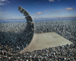
As more buildings are being scanned, the area of 3D modelling and reconstruction based on satellite imaging, aerial photography and geometrical analysis represents a rising trend. Against this backdrop, the EU-funded P3DC (Processing of 3D digital cities) project aimed to develop new software and tools to analyse, model, reconstruct and manipulate scanned 3D urban scenes and structures. The first of three main objectives involved state-of-the-art interactive reconstruction of complex urban structures. The P3DC team focused on irregular structures in Europe that are difficult to reconstruct in order to overcome rooftop noise. It created a new tool that reconstructs scanned buildings with registered facades and rooftops using whatever limited data are available. Work on the second objective centred around photo-scan registration and urban data enhancement. Project partners developed a method to fuse between clearer 2D photographs and less-detailed 3D scans. This enables robust filtering and up-scaling of 3D data, helping as well to transform photographs into multi-layered depth images of urban facades. They also developed an algorithm that considerably improves the issue of 3D reconstruction from partial scans by lifting 2D shape structures into 3D. Of the three main objectives, the last addresses navigation and path visualisation in 3D urban scenes. Researchers studied ways of visualising complex 3D environments and integrating them with 2D maps for multi-layered visualisation. To this effect, they developed a method for structural summarisation and abstraction of complex spatial arrangements in architectural drawings in order to deepen understanding and perception of 3D maps. By introducing novel algorithms and tools to reliably capture and better process 3D urban-planned scenes, P3DC will help architects and engineers plan enhanced, smarter cities in much more detail than ever before.