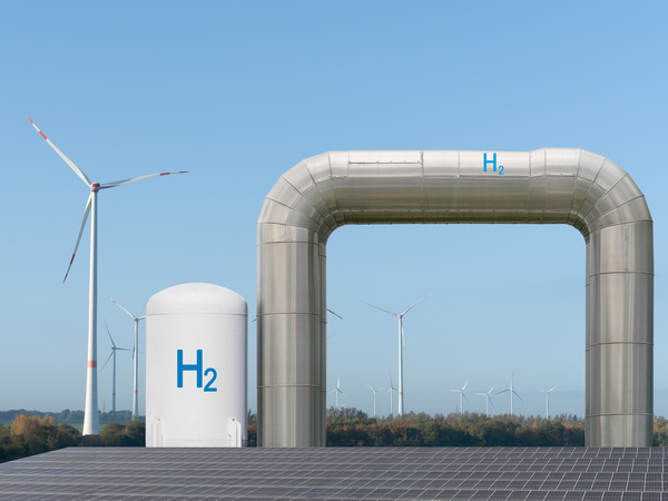
A look back in time could reveal a way forward for Europe’s uncharted treasures
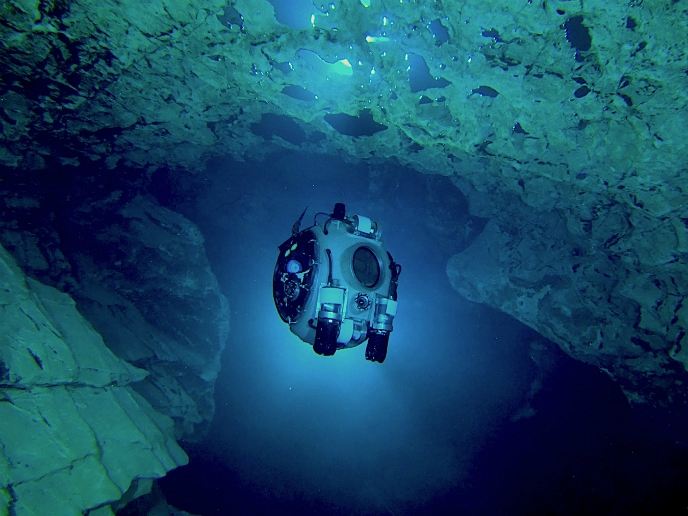
People have extracted the Earth’s minerals and metals throughout history to support innovation. Over time, advances in mining, processing and smelting have lowered mining costs and demand has created new markets such as that for rare earth elements that support green technologies(opens in new window). While many abandoned mines may be hiding valuable treasures for our economies, flooding makes human exploration difficult if not impossible. The EU-funded UNEXMIN(opens in new window) project has developed a safe, environmentally friendly and cost-effective alternative – the UX-1. Autonomous underwater robots will identify mines with potential. Reopening them could boost the EU economy and relieve dependence on imports for critical raw materials.
Robotic explorers navigate and analyse flooded mines
UNEXMIN’s sophisticated multi-robot platform was developed to explore the flooded mines and retrieve geological data. Having multiple robots working as a team serves two key purposes. It allows distribution of payloads to reduce energy consumption such that each can work longer with greater reliability. It also speeds data collection with a dispersed team exploring numerous corridors and galleries simultaneously. Project fellow Luís Lopes explains: “Real-time localisation, mapping and navigation capabilities combined with perception and survey software enable UX-1(opens in new window) to conduct autonomous exploration and analysis of complicated and hazardous underwater environments.” Spherical in shape with a diameter of around 60 cm, a single UX-1 weighs about 112 kg and can work for up to 5 hours. “The data is processed after each mission with tailor-made software that yields 3D maps and models of the mine environments and a geological analysis of the water chemistry and mine wall properties. Our combination of onboard navigation and scientific instrumentation has never been seen in a robot of this size or even in a much bigger one,” adds project coordinator Norbert Zajzon.
Rising to the challenge, descending to the depths
UNEXMIN tested the UX-1 multi-robot platform in highly varied and complex environments at five test sites including a UNESCO heritage site in Slovenia and an expansive thermal cave system in Hungary. According to Lopes, “the most exciting discoveries were in Ecton mine in the UK, closed for more than 150 years. They led to a new understanding of mineralisation and the tectonics and structural geology of the region and also elucidated how the mine worked during the 18th and 19th centuries.” In total, UX-1 made 50 dives, covering 5 000 m of shafts and galleries in 98 hours and collecting about 9 TB of data.
Broad-sweeping and evolving benefits
Aside from mining companies, UX-1 can support both public and private enterprises in numerous ways. Zajzon explains: “Geological surveys, governmental bodies and universities can use the data for educational purposes. Water supply companies can assess their pipelines, environmental companies can assess underwater risks to the public, and even tourist sites can use the data for marketing to potential visitors.” The team has secured funding for further development from EIT RawMaterials(opens in new window), the largest raw materials consortium in the world. In the meantime, the spin-off company UNEXMIN GeoRobotics(opens in new window) will enable commercial usage of the current UNEXMIN technology.