Data fusion unlocks the potential of geo-intelligence in mining
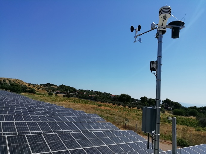
Modern society relies heavily on significant quantities of mineral resources essential to machinery, vehicles, electronics, smartphones and computers. As mineral demand is expected to rise owing to renewable energy, electric vehicles and advanced electronics, the mining industry will face significant challenges. Mining operations must prioritise workers’ safety and environmental protection despite challenges posed by the scarcity of high-grade deposits often located in remote or densely populated areas. Marko Paavola (Technical Research Centre of Finland Ltd., VTT), coordinator of the EU-funded Goldeneye project, states: “Increased automation and Earth observation will greatly change the future of mining. The monitoring of mining activities such as employee location, mine slope stability, asset management and environmental control will see significant advancements.” Paavola highlights that the key to this evolution lies in harnessing multiple data sources – satellite imagery, drone and aerial surveys – and in situ sensors or instruments.
Intelligent, easy-to-use platform automating the mining industry
The Goldeneye consortium is developing an AI platform that enables novel uses of Earth observation data in the mining industry. “The Golden AI platform fuses satellite, drone and in situ sensor data with automated data pre-processing and state-of-the-art visualisation tools. The end result will be analytical maps that are easily accessible to mining site operators, eliminating the need for in-depth knowledge of data collection and processing,” notes Paavola. Data fusion integrates data from two or more sources over the same area with comparable resolutions, significantly improving data quality. The process can also be beneficial for data with different spatial or temporal resolutions. “For instance, the temporal resolution of low-resolution, low-frequency satellite data can be enhanced by integrating data from higher-resolution yet higher-frequency sources,” explains Paavola. The Golden AI platform also allows combining geophysical data from drone missions and in situ Raman spectroscopy measurements or active hyperspectral imaging. The resulting data fusion products are added to a stack of generated analysis ready data in the European Space Agency Data Cube facility for reuse. The groundbreaking platform automates the recognition of known patterns in the fused data by creating specific AI knowledge packs (AKPs) developed for different use cases. These AKPs are independent of language and development tools, meaning any AI tool compatible with the Golden AI platform can be utilised.
Successful technology demonstrations
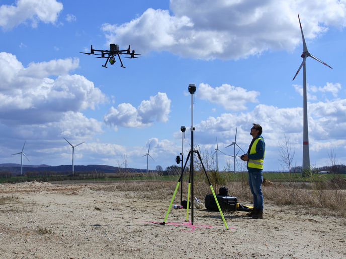
Goldeneye has conducted successful field campaigns in various European countries. Its use cases cover mineral detection, safety monitoring, operational management, geohazard monitoring and environmental monitoring. “Our automated environmental monitoring solutions have been instrumental in overseeing large water bodies like lakes and tailing ponds and detecting ground displacement in large areas reducing human effort by at least 50 %,” remarks Paavola. State-of-the-art technologies like drone-based 3D mapping and electromagnetic sensing help reduce human effort in exploration targeting by over 80 % when combined with best exploration practices. Such methods can significantly mitigate the environmental impact of exploration activities by reducing drilling volumes by over 60 %. As for mining operations, Goldeneye’s technology has improved planning that has led to a 40 % decrease in energy use for blasting and drilling. “Combining different data sources, the Golden AI platform provides next-generation tools for mining safety, environmental monitoring and mineralogical mapping. Its high-level architecture serves as the foundation for a cost-efficient, scalable and commercially viable solution. The design is flexible and updatable, ready to incorporate novel technologies in the future,” concludes Paavola. The Hypermine(opens in new window) team at project partner VTT(opens in new window) continues the development of laser-based mineralogy sensing for mining applications. According to Mikhail Mekhrengin, lead of the development, the solution is being piloted in South African and Brazilian mines. Moreover, the team is looking for venture capital.