The big picture of Europe's marine ecosystem
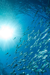
Europe's fish stocks are under pressure from pollution and in many cases over-fishing. Coastal waters along the Caspian and Black Seas, for example, are under threat from uncontrolled urban and industrial development. The risk of losing valuable habitants and biodiversity is serious. A critical step in preserving marine ecosystems is to take stock of their condition. But it is notoriously difficult to produce a comprehensive picture of the state of Europe's seas. The EU-funded Monruk project looked to change that. It monitored the marine environment in Russia, Ukraine and Kazakhstan using satellite synthetic aperture radar (SAR) images which capture larger sea areas. High-resolution images collected by the Envisat satellite were analysed along with optical and infrared images, as well as in-situ observations from offshore platforms, to get a better picture of what is happening to seas in the region. Interpreting radar images to identify, for example, patterns linked to surface winds, currents and waves is complex. So the team fed the SAR data into a numerical radar imaging model (RIM) which provided a clearer reading on real events, such as an oil spill in the Caspian Sea. The researchers used the radar measurements to determine patterns of oil dispersion and movements of pollution. With the EU-funded part of the project now over, the team is eager to follow up their initial findings with further research. Existing algorithms need to be made more robust, and future satellite sensors will require new methods and tools to be developed. And further effort will be needed to validate information products that provide a reliable picture of Europe’s marine ecosystem to decision-makers.