Innovative geospatial tools for mapping land rights in East Africa faster, easier and cheaper
“It’s estimated that over 70 % of land tenure rights aren’t mapped in developing countries, and traditional surveying methods are too slow and costly,” notes Mila Koeva, coordinator of the EU-funded its4land(opens in new window) project. Land administration systems in SSA face several challenges, including incomplete records of deeds and other property instruments in registries, and unresolved or escalated disputes that exacerbate small- and large-scale investments. “There’s a clear need for innovations to tackle the challenge of mapping in a fast and cost-efficient way,” comments Koeva.
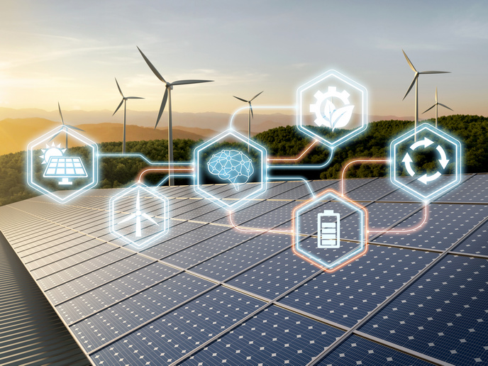
ICT innovations playing key role in land rights
Project partners developed an innovative suite of land tenure recording tools based on geoinformation technologies that respond to the needs of end users, such as local communities, SMEs, non governmental organisations (NGOs) and government. The tools reinforce an existing strategic collaboration between the EU and East Africa. The partners performed data collection, piloting and demonstration activities at rural communities in Ethiopia, Kenya and Rwanda. “These tools are an answer to SSA’s immense challenge of rapidly and economically mapping millions of unrecognised land rights in the region,” comments Koeva. “Many existing ICT-based approaches to land tenure recording in the region have failed. Disputes abound, investment is impeded and the communities’ poorest lose out.” The tools are marketed as a product or service and offered to the public.
Land administration toolbox and models
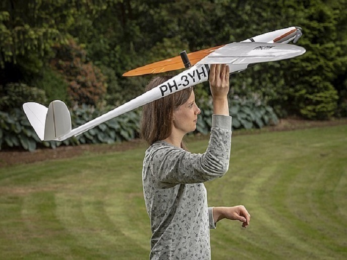
To assess specific key stakeholder needs, market opportunities and readiness of end users in land tenure information recording, the its4land team organised reconnaissance visits to the sites and workshops in the three countries. “We produced one of the first fully detailed needs assessment in land administration,” adds Koeva. A software tool called SmartSkeMa(opens in new window) extracts objects represented by symbols from a map. It consists of a specialised domain model and an associated visual language for sketching, a system for automated recognition and extraction of objects in sketch maps, and a system that integrates sketched information into existing geo-referenced data sets using qualitative representations. SmartSkeMa is beneficial for NGOs, private organisations, research institutions and government agencies that use sketching as part of their work in land or natural resources sectors. Team members devised data acquisition guidelines for drones, and designed, tested and validated customisable workflows for land administration. They released policy and legal requirements(opens in new window) involving drone data acquisition workflows for the three countries. Three drones were delivered to the target countries to map land ownership. An open-source tool(opens in new window) was developed for interactive automatic cadastral boundary extraction based on remote sensing images aiming to improve the current mapping procedures in terms of cost, time and accuracy. The ‘Publish and Share’ platform(opens in new window) supports the implementation of tasks related to land administration systems. It operates, integrates and disseminates land administration workflows and functionalities. A governance and capacity building development model(opens in new window) supports the implementation and evaluation of the its4land tools to meet stakeholder needs. A sustainable business model(opens in new window) demonstrates how to commercialise all the tools. “its4land’s novel ICT tools and accompanying models improve land tenure mapping by providing faster and less costly land rights recording in East African countries,” concludes Koeva. “They enable local communities and governments alike to adjudicate, demarcate, survey and record land tenure information that for too long was unavailable or concealed.”