Reconstructing the Roman Empire’s transport network
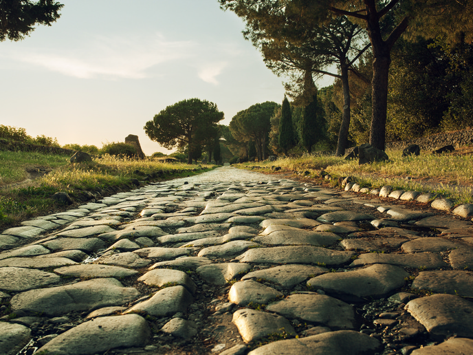
The Roman Empire was one of the largest empires of the ancient world. At its peak during the 2nd century CE, it spanned roughly 6 million square kilometres over Europe, Asia and Africa. Two of the most profound impacts on the physical world were the introduction of a widespread transport network and the large-scale development of cities it enabled. Yet, due to incomplete analysis and scant archaeological evidence of many routes, an understanding of this network’s influence through time has remained elusive. “We have a fairly good knowledge of the broad routes the roads took from some actual physical remains, as well as milestones or the occasional written itinerary,” explains Andrew Mclean, an archaeologist and researcher at the Barcelona Supercomputing Center (BSC) in Spain. “The main problem is that our knowledge is partial and lacks integration across the whole Empire,” he notes. In the EU-funded R3NUrb(opens in new window) project, Mclean and his colleagues at the BSC(opens in new window) turned to supercomputers to fill in this major knowledge gap and reconstruct and cost the entire Roman transport network. Using a combination of computation, remote sensing, network science and geostatistics, the team aimed to uncover the impact of large-scale transport connectivity on urban development in the Empire. “This project sought to automate the process of reconstructing a transport network, using only a few known sites – in this case some 40 urban centres on the edge of the Empire – to construct a fully costed network,” adds Mclean.
Constructing a cost network for transport connectivity
R3NUrb, supported by the Marie Skłodowska-Curie Actions(opens in new window) programme, followed computational approaches that used geospatial data to compute cost surfaces and probabilistic cost corridors and then construct a costed network. For land, the researchers fed in a range of factors including temperature, snow cover, altitude and details on the terrain type. Costing the sea followed a similar process but with factors such as seasonal wind patterns, current and wave height. This let the team create cost corridors and a network into which they could add new sites. For a case study on Roman urbanism, they used 1 500 urban centres.
Scaling up reconstructions
So far, the researchers have developed small-scale reconstructions of the entire network and are in the final stages of scaling it up to 100 m resolution. Already, the team has learned that using costs that reflect temporal changes can drastically change not only absolute costs but also relative costs in a model, something previously overlooked in archaeological mobility studies. The results also reinforce that Roman urban centres typically lie along natural movement corridors. “More importantly, for the first time, our results show that the corridors along which Roman urban centres lie are far less affected by seasonal conditions as compared to the wider landscape, and remain seasonally viable even when different routes may not be.”
A Google Maps for the Roman Empire
The team will soon publish the results of the terrestrial network and is simultaneously working on integrating the maritime network. One researcher is working on inland waterways, while a future collaboration with archaeobotanists at ICAC(opens in new window) will model archaeobotanical remains across the Empire. “Our ultimate aim is to develop an interactive, user-friendly, multimodal tool for modelling movement costs across the whole Empire – a ‘Google Maps’ for the Roman Empire,” says Mclean. “We hope, going forward, to demonstrate its utility for different periods and regions.”