New AI maps help protect biodiversity across sectors
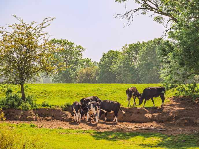
Biodiversity decisions often depend on incomplete data. A site might have a few surveys conducted in different years by different teams using different methods. This makes it difficult to compare locations, spot trends early and explain trade-offs when new infrastructure, land use or conservation measures are being considered. The EU-funded GUARDEN project(opens in new window) set out to improve the situation with a practical monitoring toolbox. By combining satellite-based indicators, AI modelling, citizen-science platforms, acoustic sensors and augmented reality tools, it aims to enable more frequent updates to biodiversity and ecosystem services information and to support the application of that information in real-world planning.
Satellite and AI indicators that scale across landscapes
GUARDEN’s most consistent results came from combining Earth observation with AI-based ecological modelling. As project coordinator Pierre Bonnet explains, “In real-world conditions, the combination of Earth observation data with AI-based ecological modelling proved to be one of the most robust and scalable monitoring approaches within GUARDEN.” Those satellite-derived habitat indicators were designed to be repeatable across different landscapes and governance contexts, supporting comparisons between areas and scenarios. To make the outputs easier to use, GUARDEN made its map set accessible through the GeoPl@ntNet web mapping tool(opens in new window). The approach works best for landscape-scale patterns and trend tracking, while fine-scale local features and rare species can still be hard to capture without targeted fieldwork.
Blending methods to reduce blind spots
GUARDEN treated monitoring as a combination problem, because each method breaks in a different way. Citizen science observations via specific platforms, namely MINKA and Pl@ntNet, can provide valuable field records; however, they are sensitive to uneven sampling effort and observer bias. Acoustic sensors can be highly repeatable, but performance drops when recordings are masked by wind, rain and machinery or when target species are rare. The project’s takeaway is blunt: “One key lesson was that no single monitoring method is sufficient on its own. The most reliable results emerged when tools were explicitly combined, with each one compensating for the blind spots of the others,” says Bonnet. Before data entered models, GUARDEN added quality-control layers including duplicate and anomaly checks, confidence scoring for identifications, uncertainty thresholds, and cross-validation using reference datasets and expert-reviewed samples.
Ground validation, benchmarking and what changed on the ground
Validation was iterative, mixing targeted field surveys, existing monitoring programmes, expert assessments and citizen observations. A notable technical step was benchmarking GUARDEN’s deep learning framework through the GeoLifeCLEF(opens in new window) and PlantCLEF(opens in new window) international challenges, providing external performance benchmarks and helping calibrate models. When the maps and field observations diverged, the response was to diagnose and adjust rather than discard. Bonnet notes, “When discrepancies emerged between field observations and model outputs, they were treated as signals for improvement rather than failures.” Causes included training data gaps, scale effects and local management factors, with local refinements made where needed, including for legal expectations. In practice, GUARDEN outputs informed route option reviews for transport infrastructure, helped concentrate field surveys on model-flagged hotspots, supported management prioritisation in peri-urban habitats and enabled quicker flagging of potentially invasive species using citizen data.