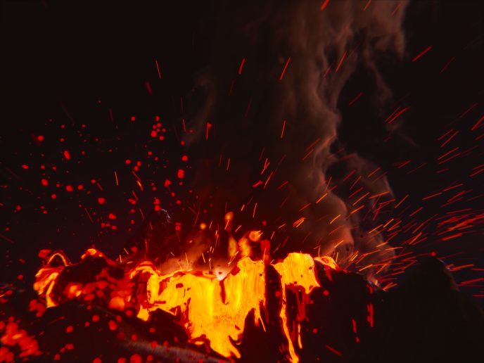
Monitoring volcanoes from space
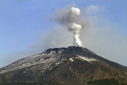
Within the Global Monitoring for Environment and Security (GMES) framework — now named Copernicus — the 'European volcano observatory space services' (EVOSS)(opens in new window) project developed a new satellite-based volcano observatory. A 'cloud' of specialised computer servers automatically detect and monitor erupting volcanoes in Africa and Europe and volcanic islands in surrounding oceans. Specifically, the system measures eruptions in three different ways: the heat coming from a volcano, the ash and gases being emitted, and the physical changes on the Earth's surface. These readings are subjected to inter-satellite validation to minimise errors and to help scientists better anticipate how a volcano is likely to behave in the future – for example, whether activity is escalating or decreasing. The system was designed to act from situations of sustained volcanic unrest to situations in which volcanoes erupt. A study, carried out within the EVOSS project, showed that in principle this is feasible with the current generation of satellites and will be more effective with those in future. During the project's life cycle, three events were particularly significant in validating concepts and services. The first, at Nabro in Eritrea, saw this remote volcano emitting a huge cloud of ash, steam and sulphur dioxide. However, with no record of activity in the past, the eruption's progression went completely unmonitored on the ground. Using its satellite-based system, EVOSS was able to detect and observe the full 36 days of activity in 2011. The other two events were related to the permanent activity of the high lava lake Nyiragongo and the eruption of Mount Nyamulagira, which began in 2011. Both took place in the Democratic Republic of the Congo and demonstrated the need for satellite data. The EVOSS system also detected forest fires in Sicily and Tanzania and discriminated them from volcanic events. Looking ahead, the EVOSS team hopes to further prove the potential of remote sensing to improve the response capacity of EU volcano observatories. They also intend to expand the system to predict and monitor volcano activity in America and Asia, and to disseminate the real-time data to relevant civil protection authorities.