For rigorous geospatial information
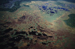
The abundance of geographical data used in commercial, industrial and daily applications has brought an ever growing awareness about its accuracy and completeness. Moreover, this data is difficult to be combined with current data coming from Geographical Information Systems (GIS) due the quantitative nature of the GIS. Urged by this the REGVIS project focused on exploring new theories and tools for increasing accuracy of uncertain geographical information. Aided by fuzzy logics the project research employed fusion of various formal techniques in order to handle spatial data uncertainty. One of the key project results involved a study on different segmentation approaches including grey-level and multivariate texture for fuzzy object identification. Quantification of object uncertainty offers identification of transition zones for object with unclear boundaries. Using the Local Binary Pattern (LBP) operator modelling texture, homogenous texture regions in an image are specified. In order to offer colour texture descriptions researchers focused on the extension of the standard univariate LBP operator to a multivariate version using two case studies. The first study involved an image with five texture regions with two LBP operators offering good segmentation results. The second study involves segmentation of coastal landform and land cover objects using special geographic data. This data are LIght Detection And Ranging (LIDAR) Digital Elevation Models (DEM) and Compact Airborne Spectrographic Imager (CASI) images from a coastal area in UK. In comparison to the univariate LBP operator, the multivariate LBP operator allows better segmentation of the area into objects. Being used as an extension to standard texture classifiers it may reveal significant information on uncertainty at the transition zones. The algorithm has already been included in a software prototype called Parbat that is available at: http://parbat.lucieer.net(odnośnik otworzy się w nowym oknie).