

Comprehensive information on contaminated and waste disposal sites
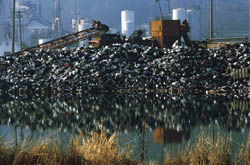
Brownfields are contaminated areas and waste disposal sites that constitute a serious problem concerning land management and quality of environment. Since decontamination processes are expensive and difficult to implement, remedial studies and hazardous waste cleanup actions need to rely on reliable and accurate information. Obtaining such information is a considerably time and effort consuming procedure and hence, a costly one. Answering this need, the HYGEIA project focused on developing hybrid geophysical technology for the evaluation of insidious contaminated areas. The developed, reliable non-intrusive technology for subsurface characterisation of contaminated land can significantly reduce the costs of rehabilitation using integrated geophysical techniques, including GPR, resistivity and multi-component seismic. Application of these techniques allowed researchers to perform analyses of the brownfield typologies to gather data related to site environmental characterisation. The derived database of characteristics of brownfields and contaminated sites is aimed at providing options for remedial evaluation steps as well as plan management and rehabilitation actions. Provision has been made to involve time and cost constraints required to be met by the geophysical investigations. Additionally, the database features increase flexibility, applicability and accessibility as a tool to be employed in compliance to conventional investigation methods for environmental assessment. Validation of the database's effectiveness concerning remediation and post-remedial monitoring programs can be made by application of geophysical measurements at regular time intervals. Moreover, calibration of the new technologies and design/test of geophysical procedures for the sites assessment can also be achieved through definition of site typologies. Therefore, the users not only have the capability to select between available options, but have also the potential to extend the experimental opportunities and benefit from the exploitation of the methodological results.