Mapping sea surface features for coastal management
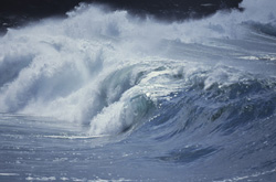
Tourism and industry have detrimental affects on nature. These activities need to be balanced in a way that will allow optimal exploitation of the coastal zone and at the same time mitigate human involvement. To this end coastal management has to be engaged in a broad variety of processes. Among others, the monitoring of eroding forces, such as wind, waves, currents and small scaled eddies is of vital importance for the maintenance of the coastal zone. However, for the effective management of the coastal nature it is indispensable to ensure the loss-free transfer of environmental information obtained by monitoring. OROMA, a research project supported by the European Commission, aimed to provide coastal managers with a thorough understanding of the information contained within measured data. By increasing the basic knowledge on the physics involved within monitoring technologies, innovative radar mapping methods were designed. The basic instrument for performing current measurements was an x-band coherent radar, which operates from two stations based either on land or ship. For each radar pulse not only the distance and the intensity of the scatterer, but also the phase shift due to the scatterer's motion could be detected. Both signal phase and amplitude were required by the radar to determine sea surface characteristics. To obtain the current fields over several tidal cycles, time series of the radar backscatter were acquired from radar stations operating subsequently. The surface current had to be extracted by subtracting velocity vectors caused by wave motion and wind drift. The radar was operated from two stations to obtain Doppler-velocity components which were corrected and combined with current vectors. The presented measuring system was developed as part of a larger framework, aimed at observing high resolution hydrodynamics surface features, which would be integrated in a set of mapping and representing tools. The applications of the method are numerous and could help engineers planning civil works in coastal areas as well as oceanographers working on the coastal protection.