

ESA satellite joins fight against coastal erosion
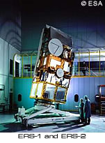
British scientists are making use of a European Space Agency (ESA) satellite to measure the UK's rapidly receding coastline with unprecedented accuracy. Scientists from the University of Newcastle are using images from the satellite along with a microlight aircraft and advanced computer technology to create a highly accurate 3D computer model which will illustrate the pattern of erosion. The new technique is being piloted at Filey Bay on the North Yorkshire coast, UK which is estimated to be eroding by 25 centimetres each year. Small changes to the coastline are recorded each month by the ESA's European remote sensing satellite ERS-2. This information is used in combination with more detailed results gained 'in the field' using global positioning system (GPS) equipment and digital aerial photographs from a microlight aircraft to produce the 3D model of the coastline. Coastal erosion, which costs the UK government alone millions of pounds each year, is fast becoming a major international problem. Current measurement techniques provide only annual estimates of erosion rates. Simon Buckley, one of the project researchers, said: 'Until recently there has been limited means of measuring the exact pattern of erosion, but our methods should be able to establish more accurately the trends at certain locations.' The model will also allow scientists to predict erosion rates and identify vulnerable areas. The method used may eventually be applied on an international basis. It is now over 10 years since ESA's ERS satellite first began providing environmental data. Instruments on board the satellite constantly keep watch over the earth and provide precise and timely environmental data for users.